

Sept 20: Karl to Sleep with the Fish
Model guidance as well as live observations suggest Karl staying out to sea. Bermuda interests however should still monitor and the US East Coast should expect more strong rip currents and possibly some increased swell. On top of that, Tropical Storm Lisa has formed. Let’s break it down…
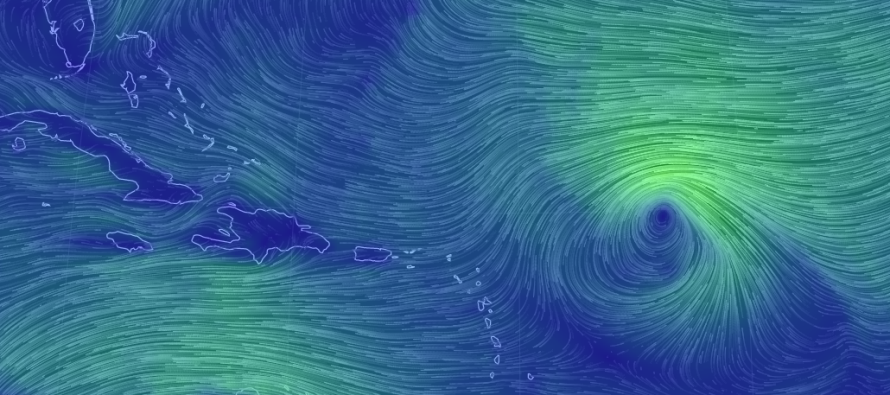
It has now become apparent on both model guidance and upstream observations that upper level energy will break down the ridge and capture the shortwaves associated with the remnants of Julia, Karl and now Lisa. The ridge was the only chance of Karl making it into the US East Coast. It would have allowed an area for Karl to slip in due to a missed trough connection. That is now off the table as the ridge clearly breaks down in time.
Instead Karl will, again, absorb into the northern stream at the upper levels. At the surface this means Karl will re-curve out to sea before reaching anywhere near the US East Coast. The only problem with this is that Karl will enter the Bermuda Triangle before re-curving and could possibly place Bermuda in a bad spot. I’m sure this will come into the spotlight for Bermuda interests in the next few days. With any luck, Karl will re-curve sooner and miss Bermuda to the E.
Lisa has formed but should remain well out to sea. She should turn N very soon and stay out in the middle of the Atlantic Ocean.

In English: Karl will not make direct impact to the US East Coast. It could however generate strong rip currents for us and possibly threaten Bermuda as a hurricane this weekend. Another storm, Lisa, has formed but is expected to stay way out in the Atlantic Ocean. Be safe! JC
Jonathan Carr (JC) is the founder and sole operator of Weather NJ, New Jersey’s largest independent weather reporting agency. Since 2010, Jonathan has provided weather safety discussion and forecasting services for New Jersey and surrounding areas through the web and social media. Originally branded as Severe NJ Weather (before 2014), Weather NJ is proud to bring you accurate and responsible forecast discussion ahead of high-stakes weather scenarios that impact this great garden state of ours. All Weather. All New Jersey.™ Be safe! JC


LOCAL FORECAST | INTERACTIVE RADAR | LATEST NJ WEATHER ALERTS | WEDDING FORECAST| PRIVACY POLICY
© Copyright 2026 Weather NJ LLC. All Rights Reserved.
Some information that can be found on our website is provided by a private weather station and is not an officially recognized station for weather reporting. Though we always strive to achieve accurate reporting for our own use, it is important that you do NOT depend on the data provided here for any purpose.
