

Sept 23: Maria to Miss New Jersey
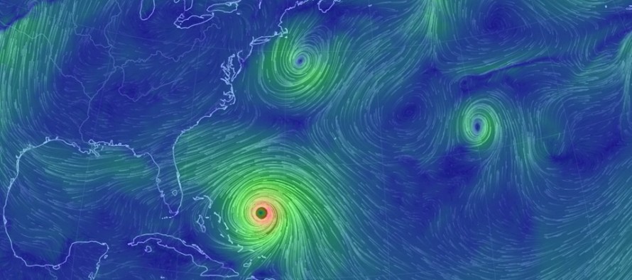
Discussion: The 12Z model suite today unanimously initialized with good agreement on live-observations, especially with respect to the 250-500mb flow around the approaching trough. Therefore, I’m confident in serious upper-level E/NE (out to sea) steering currents north of the 35N latitude later this week…when Maria is expected to approach the Mid-Atlantic US. This means I expect Maria to miss New Jersey with a rapid curve to the E/NE regardless of OBX impacts just before.
OBX should still be on alert. Most ensemble packages still have numerous hits on the west side of their spreads. The majority of ensemble members however are offshore of OBX. Given the diameter of Maria, even a close miss offshore could produce tropical storm conditions for most of OBX. Therefore, OBX is on the hook for anything from weak tropical storm-like conditions to a category 1-2 hit. You might see the National Hurricane Center issue watches tomorrow for that area. Eastern Virginia and Delmarva are a difficult forecast but given closer proximity to Maria’s core, I would expect at least moderate winds with a better chance of a few rain bands reaching far enough northward. Here’s the latest update from the National Hurricane Center:
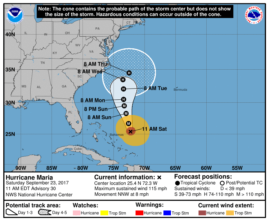
Note that the cone of uncertainty includes the Outer Banks of North Carolina. Even if Maria took the path right down the middle of the cone, OBX would still likely be grazed with tropical storm-like conditions. Given the westward trend of collective model guidance, my gut is that Maria will stay on the west side of the cone…but still inside the cone before making the curve out to sea. With that said, please also note the sharp turn to the NE before reaching the 35N latitude. From that point and forward, the upper-level flow (out to sea) should have her. For the most detailed analysis possible (business-level), hop in our Premium Forum.
In English: I’ve seen enough. Hurricane Maria should miss New Jersey to the southeast however could still bring disruptive conditions to the Outer Banks of North Carolina. Maria should be closest to New Jersey in the Wednesday-Thursday AM period. At this point, I think Maria will be too far to our S/SE to bring significant rain to New Jersey. For the sake of caution, let’s allow the chance for a few sprinkles should an outer band make it this far north. Also in that period I could see sustained onshore winds of ~20mph with a few gusts to ~30mph. This would obviously be felt more along the immediate coast than inland. Minor coastal flooding would be possible for usual suspect areas. The real danger here IMO is swimming-related. We’re well past the point of lifeguard duty for many beaches and this summer-like weather is still very inviting. Rip currents and wave heights should produce dangerous swimming conditions so please use caution! Otherwise, Maria should be long gone by Friday morning and we can finally relax to some cooler and more comfortable fall weather for next weekend. From now until ~Thursday, we bake. Be safe! JC
Jonathan Carr (JC) is the founder and sole operator of Weather NJ, New Jersey’s largest independent weather reporting agency. Since 2010, Jonathan has provided weather safety discussion and forecasting services for New Jersey and surrounding areas through the web and social media. Originally branded as Severe NJ Weather (before 2014), Weather NJ is proud to bring you accurate and responsible forecast discussion ahead of high-stakes weather scenarios that impact this great garden state of ours. All Weather. All New Jersey.™ Be safe! JC


LOCAL FORECAST | INTERACTIVE RADAR | LATEST NJ WEATHER ALERTS | WEDDING FORECAST| PRIVACY POLICY
© Copyright 2026 Weather NJ LLC. All Rights Reserved.
Some information that can be found on our website is provided by a private weather station and is not an officially recognized station for weather reporting. Though we always strive to achieve accurate reporting for our own use, it is important that you do NOT depend on the data provided here for any purpose.
