

Sept 23: Weekend Rain Detected
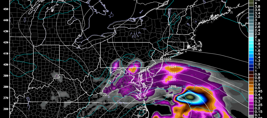
A weak coastal low pressure disturbance will be the main driver of possible rain and nuisance conditions this weekend. The rain could begin as early as Saturday afternoon/evening and last through Monday evening. High pressure to the north will block the system, forcing it to crawl along the coast from OBX to the benchmark (40N/70W) area, and be the reason for such a long-duration event. To be crystal clear, NNJ/NWNJ has the least chance of seeing rainfall and SNJ/SENJ has the best chance. Everyone in-between could go either way. The northern fringe of the systems precipitation shield should cut right through New Jersey, making the weather just fine to the N/NW of that line and full of nuisance to the S/SE. Let’s look at some supporting 850mb model guidance from the GFS:
Rainfall between 2PM and 8PM on Saturday:
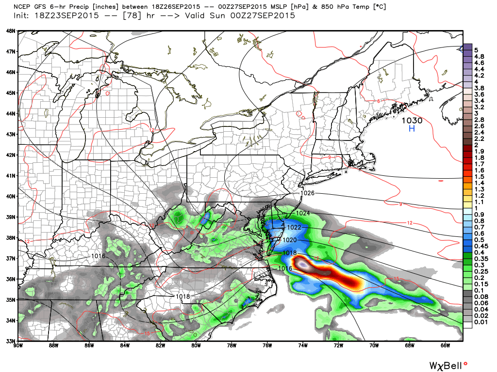
Rainfall between 2AM and 8AM on Sunday:
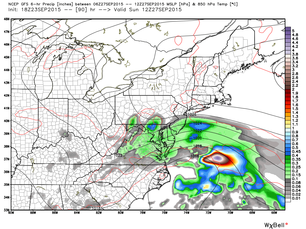
Rainfall between 8PM Sunday and 2AM on Monday:
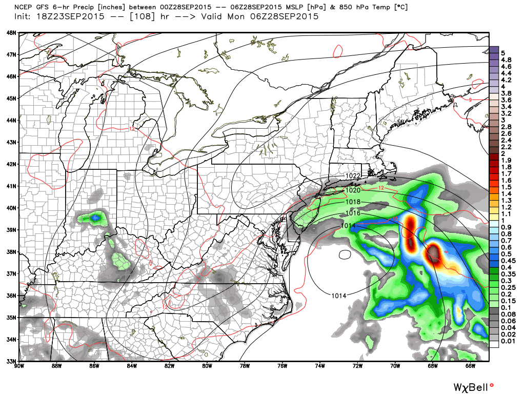
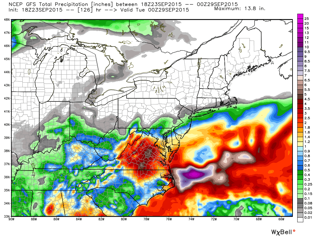
Total rainfall through 8PM Monday:
The bottom line: This will be an on-and-off rainfall situation Saturday PM-Monday PM with SENJ seeing the most and NWNJ seeing the least. We should have nice weather until then and gorgeous weather afterwards once everything clears out on Monday. I’ll have more detail and specifics for you when I make the weekend outlook tomorrow evening. Be safe! JC
Model images used with permission from WeatherBell Analytics.
Jonathan Carr (JC) is the founder and sole operator of Weather NJ, New Jersey’s largest independent weather reporting agency. Since 2010, Jonathan has provided weather safety discussion and forecasting services for New Jersey and surrounding areas through the web and social media. Originally branded as Severe NJ Weather (before 2014), Weather NJ is proud to bring you accurate and responsible forecast discussion ahead of high-stakes weather scenarios that impact this great garden state of ours. All Weather. All New Jersey.™ Be safe! JC


LOCAL FORECAST | INTERACTIVE RADAR | LATEST NJ WEATHER ALERTS | WEDDING FORECAST| PRIVACY POLICY
© Copyright 2026 Weather NJ LLC. All Rights Reserved.
Some information that can be found on our website is provided by a private weather station and is not an officially recognized station for weather reporting. Though we always strive to achieve accurate reporting for our own use, it is important that you do NOT depend on the data provided here for any purpose.
