

Sept 3: Dorian to Affect New Jersey
Discussion: So that there is no confusion Dorian will NOT make landfall or even come close to making landfall on the New Jersey coast. This article is about how the far-NW side of the cyclone will affect New Jersey between Thursday night and Saturday morning.
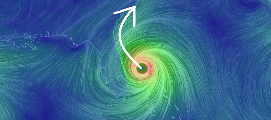
Per the latest (5PM) National Hurricane Center update Dorian is still packing sustained winds of 110mph and is moving NW at 6mph with a central pressure of 959mb.
I’ve never seen a hurricane sit so stationary for so long. That’s what it did most of yesterday over the island of Grand Bahama. I saw some damage photos and videos today and it’s just heart breaking. Even though the Bahamas are mostly flat the friction still took its toll on Dorian and allowed weakening of the overall storm system. Dorian is now moving across the Gulf Stream which could result in some re-strengthening.
Florida landfall is likely off the table although some recent guidance puts Dorian alarmingly closer to the coast when passing near the Jacksonville, FL/Savannah, GA area by late Wednesday night/early Thursday AM. Points from Cape Canaveral and S along the E Florida coast are likely off the hook for anything more than outer rain bands, moderate wind gusts and elevated storm surge levels. Landfall posiiblity is then back on the table for South and North Carolina (anywhere between Charleston, SC and OBX) between Thursday PM and Friday PM. If not landfall then close enough to bring hazardous conditions to SC/NC coastal areas including storm surge, flooding rain and moderate-to-hurricane-force winds.
By Thursday PM New Jersey should start to feel the initial outer effects of Dorian. I expect extra-tropical transition and a general expansion of the highest wind fields as Dorian gains latitude up the east coast. These effects should start with a stiff E/SE onshore flow off the ocean. I still think Friday is going to feature the peak conditions that New Jersey will see from Dorian. The Cape May to LBI (maybe up to Belmar) region of the SENJ coast should see the highest wind gusts (sustained 30-40mph with gusts to 60mph). Areas N and W of SENJ should experience less winds due to land friction. As far as rainfall goes New Jersey is subject to the NW outer rain bands of the system. These rain bands could produce tropical downpours at times. If Dorian is tightly wrapped up offshore then only SENJ would see on-and-off periods of lighter rain. If Dorian is captured a little more by the upper-level low energy and/or there is more frontal interaction then heavier rainfall could extend as far W as the Delaware River and as far N as NNJ.
Minor coastal flooding is likely along the Delaware Bay and Atlantic Ocean-facing coasts. Moderate coastal flooding is possible especially for the SENJ coast. The period of coastal flooding potential should begin Thursday PM and subside Saturday AM. By Sunrise Saturday all Dorian-related effects should be out to sea leaving all of New Jersey in the wake of cooler temperatures and SUPER-low humidity. Dorian should then go on to impact coastal New England and SE Canada as a damn-strong mid-latitude cyclone. There’s even talk of snow on the NW side of it once up into Canada. New Jersey should see amazing weather conditions most of Saturday and Sunday.
In English: Moderate-to-heavy rain, gusty winds and coastal flooding are likely this Friday in New Jersey (especially SENJ) between Thursday night and Saturday morning. In this time period Dorian will be moving away from the Outer Banks of North Carolina to the NE (out to sea and well to the SE of NJ). Delmarva and at least SENJ are close enough during this period to experience the far-NW effects of the cyclone. Coastal flooding and SENJ wind gusts are what I feel will dominate the headlines for this period. Therefore I would expect strong nor-easter-like conditions on Friday. Everything should then clear out early Saturday AM leaving beautiful conditions across New Jersey Saturday and Sunday. The tropics continue to heat up across the Atlantic Ocean as we push through peak hurricane season. I’ve got the September long-range outlook coming a little later tonight. Have a great evening and be safe! JC
Download the new free Weather NJ mobile app on Apple and/or Android. It’s the easiest way to never miss Weather NJ content. Our premium services go even further above and beyond at the hyper-local level. Looking for industrial-caliber long-range forecasting data that I personally recommend? Check out WeatherTrends360!
Jonathan Carr (JC) is the founder and sole operator of Weather NJ, New Jersey’s largest independent weather reporting agency. Since 2010, Jonathan has provided weather safety discussion and forecasting services for New Jersey and surrounding areas through the web and social media. Originally branded as Severe NJ Weather (before 2014), Weather NJ is proud to bring you accurate and responsible forecast discussion ahead of high-stakes weather scenarios that impact this great garden state of ours. All Weather. All New Jersey.™ Be safe! JC


LOCAL FORECAST | INTERACTIVE RADAR | LATEST NJ WEATHER ALERTS | WEDDING FORECAST| PRIVACY POLICY
© Copyright 2026 Weather NJ LLC. All Rights Reserved.
Some information that can be found on our website is provided by a private weather station and is not an officially recognized station for weather reporting. Though we always strive to achieve accurate reporting for our own use, it is important that you do NOT depend on the data provided here for any purpose.
