

Sept 30: Major Hurricane Matthew
Matthew could reach category 5 hurricane status by tomorrow, if not overnight. What does this mean for New Jersey? Let’s break it down…
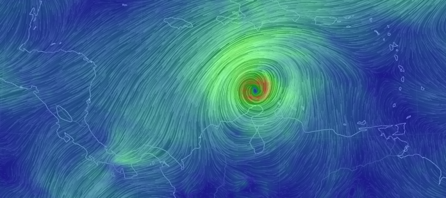
Right now, Matthew is an absolute beast churning in the Caribbean Sea. He is over 28-29C (~82-84F) water and will stay over such until he exits the N Caribbean sometime around Tuesday. This naturally brings great destructive potential to Jamaica, E Cuba, W Hispaniola and the Bahamas. Beyond that, uncertainty has never been higher. Each model is showing a different upper-level pattern with each run. Therefore, it’s impossible to hang our hat on any one run. To be honest, it won’t be until Tuesday that we have an idea of US East Coast impacts whether they be fringe from an out-to-sea track or catastrophic landfall from a direct hit.
The following graphic represents what I feel are the spread of possibilities. See the description below for what each would mean:
![]()
Scenario A: This would bring horrible impacts to Florida and the SE US in the Wednesday-Thursday period. By the time it slid up the US East Cast to New Jersey’s latitude, it would likely loose tropical characteristics and arrive in the form of moderate-to-heavy widespread rainfall towards the end of next week. This represents the far-west scenario and has little support from the latest model guidance. I only show it to represent the western bookend of possible solutions.
Scenario B: This would bring the worst case scenario to the Outer Banks of North Carolina, coastal Delmarva, coastal New Jersey, New York City and Long Island. It would rough up coastal New England pretty bad as well. This would mean hurricane force winds, heavy flooding rainfall and major coastal flooding…a top 10 event…in the Thursday-Sunday period of next week.
Scenario C: This would be the best-case scenario. The system would stay far enough offshore for no direct impacts to the US East Coast. Secondary impacts in the form of rough surf and dangerous rip currents would be possible (a surfer’s paradise). We would all be spared though.
Wildcard Scenario: Some models today hinted at a track that first comes dangerously close to Florida then curves out-to-sea around OBX/NJ before being captured by an upper-level short wave and brought back into the coast in a Sandy-like nature. The models that hinted at this brought the system back into the N US East Coast between Cape Cod and Maine late next-week. I don’t even want to show an illustration of this because of it’s ultra-rare (storm of century) nature. But it is worth mentioning, especially if models were to continue to trend this way in the coming days.
The bottom line is that storm track/storm intensity uncertainty is extremely high beyond the N Caribbean islands. It’s fairly certain that Jamaica, E Cuba, W Hispaniola and the Bahamas are in for a rough time. Beyond that and how Matthew will be pulled N into the Mid-latitudes is completely dependent on the upper-level pattern over North America. Right now, the modeled upper-level pattern that far out is laughable to trust. We should know a lot more regarding such in the Monday-Tuesday period which is when Matthew should be escaping the Caribbean over the Greater Antilles.

In English: Hope for C as the best-case outcome. A would be bad for the SE US but much better for us than B would be. B is not off the table yet but boy am I hoping it is. Unfortunately mother nature, not hope, determines this sort of thing. Most recent guidance has been leaning towards a track between B and C. I strongly advise you not to buy into any single model run at this point. Let’s watch how this system evolves and take it day by day. Not a single model had a category 4-5 ssytem at this point in time FWIW. If, and I mean only if, this storm is going to hit our area (New Jersey), it wouldn’t be until later next week (between Thursday and Sunday). I’ll be tracking. Have a great night and please be safe! JC
Jonathan Carr (JC) is the founder and sole operator of Weather NJ, New Jersey’s largest independent weather reporting agency. Since 2010, Jonathan has provided weather safety discussion and forecasting services for New Jersey and surrounding areas through the web and social media. Originally branded as Severe NJ Weather (before 2014), Weather NJ is proud to bring you accurate and responsible forecast discussion ahead of high-stakes weather scenarios that impact this great garden state of ours. All Weather. All New Jersey.™ Be safe! JC


LOCAL FORECAST | INTERACTIVE RADAR | LATEST NJ WEATHER ALERTS | WEDDING FORECAST| PRIVACY POLICY
© Copyright 2025 Weather NJ LLC. All Rights Reserved.
Some information that can be found on our website is provided by a private weather station and is not an officially recognized station for weather reporting. Though we always strive to achieve accurate reporting for our own use, it is important that you do NOT depend on the data provided here for any purpose.
