

Sept 5: New Jersey Landfall Off the Table
Discussion: I am now confident that Hurricane Irma will not be making direct landfall on New Jersey. The only New Jersey impacts that I am still watching are MUCH less threatening remnants in the form of run-of-mill rain and wind. It’s a bit hard to pin down when that would occur but my best guess is mid-week next week should Irma’s remnant energy even make it that far north. Unfortunately, Irma will likely still make landfall in the SE US still with Florida currently the primary target as early as this coming weekend. Here’s the latest National Hurricane Center’s latest update as of 8AM:
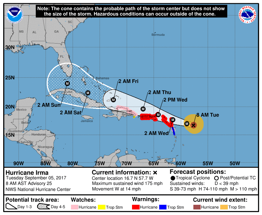
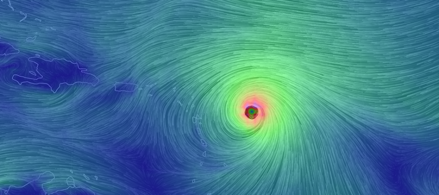
Irma is now a category 5 and has rapidly intensified overnight. The immediate danger zone exists for the northern Lesser Antilles and Puerto Rico between late tonight and early Thursday AM. Shortly after, the Bahamas and most of south/central Florida are on deck for potentially historical and catastrophic impact over the coming weekend. The jury is still out on whether the elevations of Hispaniola and Cuba will weaken Irma via geographic influences but after that she will be over very warm waters approaching Florida. There is still some uncertainty whether Irma will hit SE FL directly or possibly head towards the gulf before recurring into SW FL. Regardless, Miami is in a high-impact zone.
After that, Irma could move up the east coast however land interaction should weaken her substantially by the time she reaches our latitude. The E US trough, that I’ve been watching as a major steering current player for Irma, will likely lift out before connecting with her. This along with a dominant deep layer ridge in the Atlantic should be the driving force in keeping Irma south into the S FL area. This places a lot of the SE US at risk for damaging impacts including Georgia and possibly South Carolina in addition to Florida (but not as bad as Florida). There is also another tropical cyclone forming behind Irma but Jose (if named) would likely stay out to sea given the pattern that will eventually be carrying Irma’s remnants away.
In English: Rest easy New Jersey. Irma will not make direct landfall here. It might bring some routine rain and wind next week but that’s about it. If you have any friends or family in the Bahamas and/or Florida however, especially S FL (Miami/Keys), tell them to get out. I’m as confident as I was with Harvey in Houston and Sandy in New Jersey that catastrophic life-threatening conditions are possible for the Bahamas and Florida over the next 5-6 days. Our thoughts and concerns are with you Florida! Please be safe! JC
Jonathan Carr (JC) is the founder and sole operator of Weather NJ, New Jersey’s largest independent weather reporting agency. Since 2010, Jonathan has provided weather safety discussion and forecasting services for New Jersey and surrounding areas through the web and social media. Originally branded as Severe NJ Weather (before 2014), Weather NJ is proud to bring you accurate and responsible forecast discussion ahead of high-stakes weather scenarios that impact this great garden state of ours. All Weather. All New Jersey.™ Be safe! JC


LOCAL FORECAST | INTERACTIVE RADAR | LATEST NJ WEATHER ALERTS | WEDDING FORECAST| PRIVACY POLICY
© Copyright 2026 Weather NJ LLC. All Rights Reserved.
Some information that can be found on our website is provided by a private weather station and is not an officially recognized station for weather reporting. Though we always strive to achieve accurate reporting for our own use, it is important that you do NOT depend on the data provided here for any purpose.
