

Sept 9: Early Taste of Fall Coming

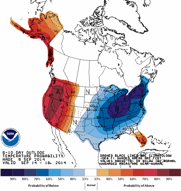
CPC 6-10 Temperature Probability
Fall is right around the corner (September 22nd), however Fall looks to be making an early entrance across the Northeast towards the end of this week. The Climate Prediction Center has placed a large chunk of the United States in a high probability of below average temperatures over the next week, which is also being backed up with model support.
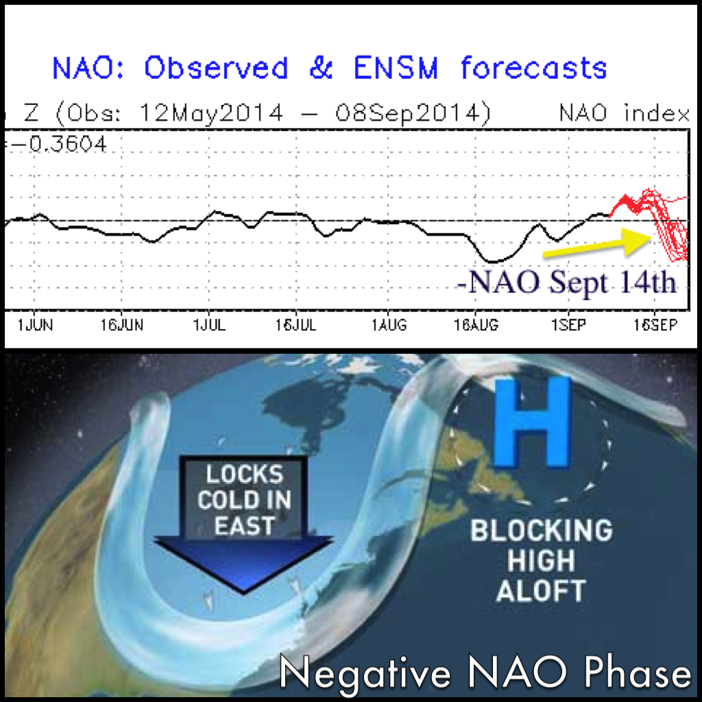
Negative NAO Phase
Taking a look at the latest teleconnections from the Climate Prediction Center (CPC), the NAO takes a noise dive towards the end of this week. When you hear we are entering a negative NAO phase, you might relate this to Winter, however this does not solely apply to Winter. A ridge (rising heights) will be building over the Western U.S. coast, while an unusually deep trough (lowering heights) for this time of year (making it as far south as the Texas Gulf Coast) will hang over the Northeast, allowing cold or cooler air, depending on location, to filter in over most of the Eastern United States, with the exception of Florida (as usual) who will maintain average to slightly above for temperatures.
After Thursday morning FOG a Cold Front will approach in the Afternoon/Evening bringing Showers, Storms, and a more HUMID airmass (SW flow) to the region ahead of it. This front clears out Friday AM, followed by another Cold Frontal passage reinforcing the shot of cool/cold air on Saturday. **See image below** This one looks to bring mainly Shower/Light Rain activity with it. **For a visual understanding on what a negative NAO looks like, see the image above…
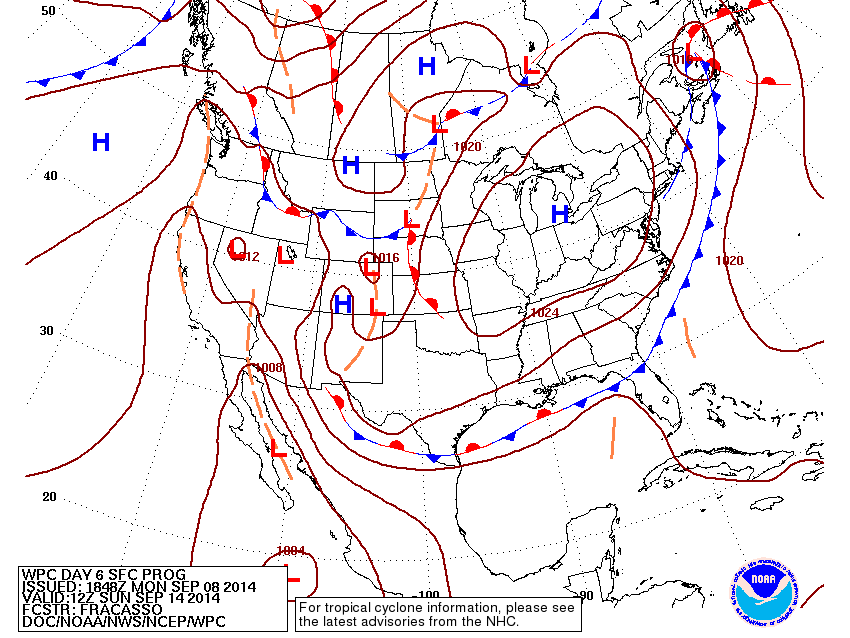
Surface map for September 14th (Cold Front)
All major models (GFS, EURO and CMC) are in a general agreement that we will be entering a below average temperature period. I am going to use the GFS to outline on what kind of temperatures we will be expecting heading into next week. The GFS clearly outlines the western ridge (building heights) and the trough in the East (lowering heights) as we head into a negative NAO phase (see image below). Starting this upcoming weekend, we will be talking about highs struggling to reach the low 70’s, with overnight lows dipping down into the upper 40’s – mid 50’s for CNJ and SNJ (coast warmest due to ocean airmass being warmer), while NNJ and especially NWNJ could flirt with low to mid 40. Upper 30’s?? We will see. If winds go calm and skies can clear at night some locations in CNJ and SNJ could drop even further into the 40’s. According to the GFS, we will be close to a negative 10 degree difference from our normal temperature departure for this time of year.
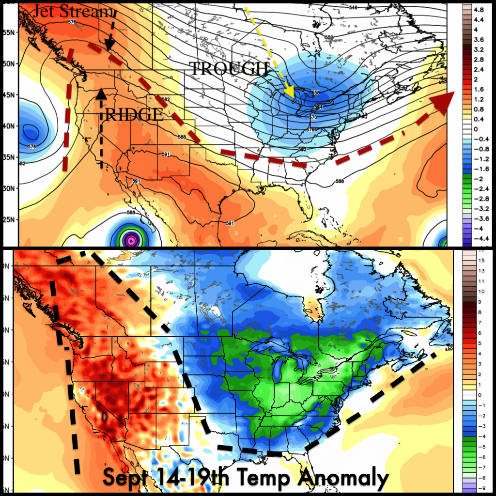
GFS Temp Anomaly
If you are a fan of the Fall like temperatures, continue to look for temperatures at or below normal at least through the middle of September. The cooler pattern is in no hurry to move out of the Northeast.
-Collaboration post by Jeff Beyerle (NJ Weather Blogs) & Marc Franz Jr (MarcsWeatherReports)-
Jonathan Carr (JC) is the founder and sole operator of Weather NJ, New Jersey’s largest independent weather reporting agency. Since 2010, Jonathan has provided weather safety discussion and forecasting services for New Jersey and surrounding areas through the web and social media. Originally branded as Severe NJ Weather (before 2014), Weather NJ is proud to bring you accurate and responsible forecast discussion ahead of high-stakes weather scenarios that impact this great garden state of ours. All Weather. All New Jersey.™ Be safe! JC


LOCAL FORECAST | INTERACTIVE RADAR | LATEST NJ WEATHER ALERTS | WEDDING FORECAST| PRIVACY POLICY
© Copyright 2026 Weather NJ LLC. All Rights Reserved.
Some information that can be found on our website is provided by a private weather station and is not an officially recognized station for weather reporting. Though we always strive to achieve accurate reporting for our own use, it is important that you do NOT depend on the data provided here for any purpose.
