

July 15: NJ Thunderstorms Moving In
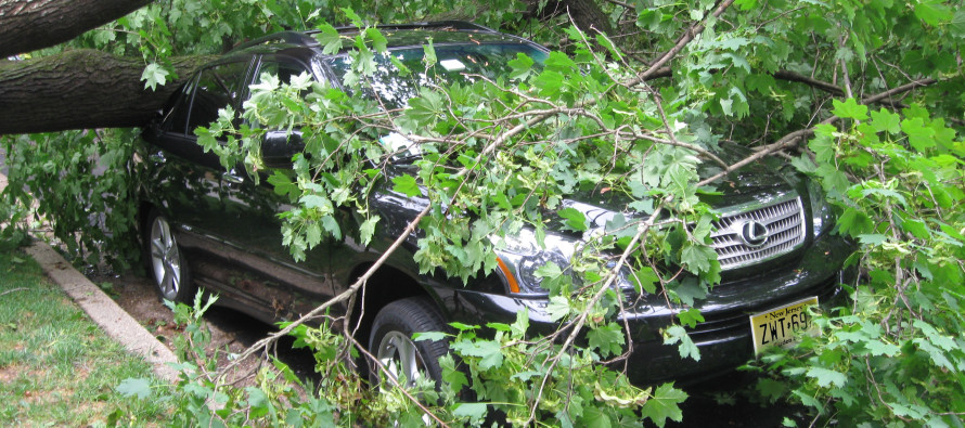
The rest of New Jersey is about to get rocked with wind and rain. Severe thunderstorms have downed trees and caused flash flooding along the I-95 corridor/northern coast since early afternoon. This is all now starting to push east thanks to the cold front driver behind it. NWNJ might escape the storms but the rest of the coast and most of CNJ/SNJ/SENJ are in for heavy rainfall, gusty winds, and lightning to finish this evening.
I think everything is going to move out quicker than expected. Model guidance had some lingering showers tomorrow morning but I think this will last until midnight or 1AM at the latest. Tomorrow we should start to feel the unseasonably cool air mass take hold of the region. For July that means highs maxing around 80 and lows dropping to around 60. We’ll stay this way through Friday and possibly into Saturday until the humidity returns. Please be safe! JC
Jonathan Carr (JC) is the founder and sole operator of Weather NJ, New Jersey’s largest independent weather reporting agency. Since 2010, Jonathan has provided weather safety discussion and forecasting services for New Jersey and surrounding areas through the web and social media. Originally branded as Severe NJ Weather (before 2014), Weather NJ is proud to bring you accurate and responsible forecast discussion ahead of high-stakes weather scenarios that impact this great garden state of ours. All Weather. All New Jersey.™ Be safe! JC


LOCAL FORECAST | INTERACTIVE RADAR | LATEST NJ WEATHER ALERTS | WEDDING FORECAST| PRIVACY POLICY
© Copyright 2026 Weather NJ LLC. All Rights Reserved.
Some information that can be found on our website is provided by a private weather station and is not an officially recognized station for weather reporting. Though we always strive to achieve accurate reporting for our own use, it is important that you do NOT depend on the data provided here for any purpose.
