

Slightly Unsettled and Volatile
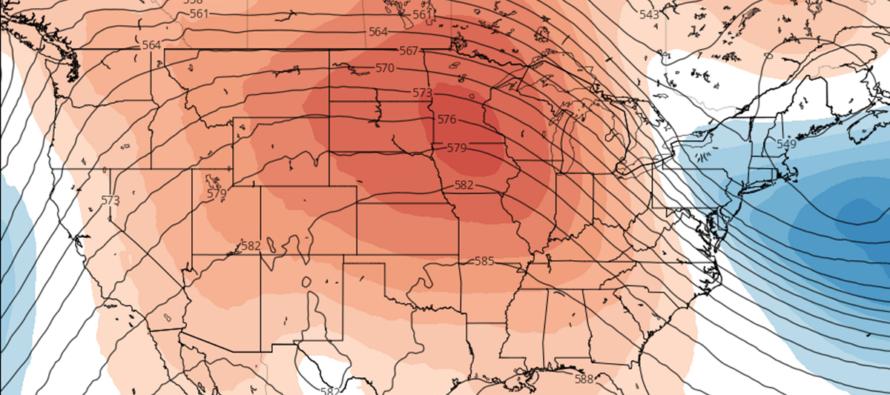
Discussion: The upper pattern appears zonal through this Friday. A few minor deviations in geopotential heights but otherwise, flat and zonal. A more meridional (dynamic) jet pattern should emerge this weekend as a ridge forms for the W US. This should reciprocate a trough and NW flow over the E US starting Friday. What does that mean in the lower levels? Well, first it means a few passing showers overnight tonight (Monday night-Tues morning) mainly for NNJ…a mostly-dry frontal passage with very light spotty precip. NJ then gets shoved into a warm sector tongue for Tuesday with SW flow and near-70 temps. A brief period of N flow then returns Wednesday to colder conditions before another warmup Thursday (mainly for SNJ). On Thursday, there should be a sagging frontal boundary draped across NJ, dividing colder and cloudier areas (NNJ) from sunny and warm areas (SNJ). CNJ would have the best chance for rain directly under the boundary’s lifting, however light rain could spill into both NNJ and SNJ. I would say Cape May would see the best conditions of the day with sun and near-70 temps. It might take from Thursday night through most of Friday for the entire boundary to push S of NJ. Saturday and Sunday then looks colder with stronger N/NW winds at the surface associated with a series of high pressure. That should then spill into next week. Overall the week looks volatile and unsettled. Today through Thursday morning looks like the driest period. A little rain Thursday (favoring NNJ) and Friday (favoring SNJ) followed by a colder and drier weekend.
Monday (Nov 6) high temperatures are maxing in the upper-50s/lower-60s. Another beautiful fall day. Skies are mostly sunny and should stay that way. Winds are light out of the E/SE. Overnight lows should range from 40-50 from NNJ elevations to SNJ coasts. Can’t rule out a shower or two mainly for N/NW areas.
Tuesday (Nov 7) high temperatures should reach near-70. Another beautiful, but unseasonably mild, fall day. Skies should be mixed with sun and clouds. Winds should be light out of the W/SW. Overnight lows should range from mid-30s to mid-40s from NNJ elevations to SNJ coasts.
Wednesday (Nov 8) high temperatures should only reach into the 50s for most NJ locations. Skies should be mostly cloudy with a cooler look and feel. Winds should be light out of the N/NW. Overnight lows should range from 40-50 from NNJ elevations to SNJ coasts as more overnight showers are possible mainly for N/NW areas.
Thursday (Nov 9) high temperatures should range a bit…near-50 for NNJ to near-70 for SNJ. Clouds and rain around mainly for NNJ/CNJ. SNJ will be the warmest with best chance for sun. Winds should be light with variable direction. Overnight lows should range from upper-30s to near-50 from NNJ elevations to SNJ coasts.
Friday (Nov 10) high temperatures should reach the low-to-mid 50s for most NJ locations. More clouds and rain around but a uniform NW wind direction. Rain should target SENJ/SNJ Overnight lows should fall into the 30s for most NJ locations with immediate coastal locations likely hugging near-40.
An early look at the weekend indicates the cooler conditions lasting through and then into next week. Might take a step cooler for Sunday-forward. Weekend skies look partly-to-mostly sunny so possibly another rainless fall weekend in-a-row. Let’s take a closer look in a few days. Have a great week and please be safe! JC
Premium Services
KABOOM Club offers inside info forecast discussion, your questions answered, and early storm impact maps (ahead of the public). At a buck per month, it’s an extremely feasible way to show support.
My Pocket Meteorologist (MPM), in partnership with EPAWA Weather Consulting, offers professional/commercial interests, whose businesses depend on outdoor weather conditions (snow plowing, landscaping, construction, etc.), with hyper-local text message alerts/forecasts and access to the MPM premium forum—the most comprehensive and technical forecast discussion available for PA and NJ.
Jonathan Carr (JC) is the founder and sole operator of Weather NJ, New Jersey’s largest independent weather reporting agency. Since 2010, Jonathan has provided weather safety discussion and forecasting services for New Jersey and surrounding areas through the web and social media. Originally branded as Severe NJ Weather (before 2014), Weather NJ is proud to bring you accurate and responsible forecast discussion ahead of high-stakes weather scenarios that impact this great garden state of ours. All Weather. All New Jersey.™ Be safe! JC


LOCAL FORECAST | INTERACTIVE RADAR | LATEST NJ WEATHER ALERTS | WEDDING FORECAST| PRIVACY POLICY
© Copyright 2025 Weather NJ LLC. All Rights Reserved.
Some information that can be found on our website is provided by a private weather station and is not an officially recognized station for weather reporting. Though we always strive to achieve accurate reporting for our own use, it is important that you do NOT depend on the data provided here for any purpose.
