

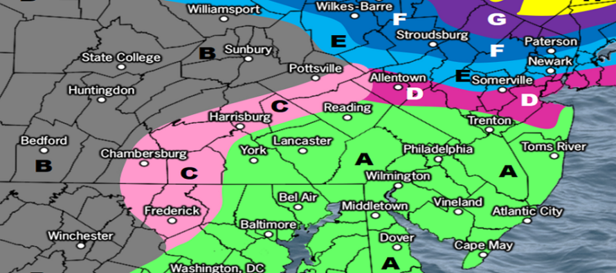
Snow Map for Monday-Tuesday
Discussion: A powerful nor’easter continues to brew which will bring major impacts to New England, NE PA, E NY, and NNJ between Monday and Tuesday. I won’t talk much more about what this is going to do to E NY (Catskills) through New England during the peak storm strength…other than it will be major, possibly historic due to the nor’easter storm track behavior. I’ll keep this article geared towards NJ impacts during the development of the storm. Let’s break it into phases:
Phase I: Snow and Rain Move In (Earlier Monday)
Winds should start picking up late tonight (Sunday night). At some point between Monday morning and afternoon, light precipitation should push into New Jersey from the SW as onshore winds continue establishing. We’re expecting to see an initial snow/rain line setup somewhere near I-80/I-287 (snow to the NW of that, rain to the SE of that). This configuration should hold for most of Monday afternoon and evening. Again, light precipitation…sort of boring. Low still to our S or SE.
Phase II: Rain Changes to Snow (Monday Night – Tuesday Morning)
At some point later Monday night, the low will get more to the E of NJ rather than SE. The low will also be dropping in pressure as it begins to rapidly develop and deepen…it will begin to bomb out as the northern stream of energy phases with the southern stream. As an inverted trough reaches back from the ocean low to the upper low, precipitation over NJ should both intensify and change to snow from NW to SE. We now expect rain to change to snow on Tuesday for most of New Jersey even CNJ and parts of SNJ. By noon Tuesday, all of NJ should be all snow.
Phase III: The Final Dump (Tuesday morning – Tuesday Night)
From about late-morning/noonish Tuesday until later Tuesday night, we expect snow to dump over New Jersey. NNJ should be cold enough to support accumulating snowfall. CNJ will take some time for the surface to chill to the point of stickage. SNJ will struggle the most to stick due to the marginal surface temperature environment. It will be much easier for the atmosphere to overcome a 32-34 surface in NNJ than a 34-36 surface in CNJ, and especially an upper-30s/lower-40s surface in SNJ. For that reason snow totals will be the most in NNJ and the least in SNJ with CNJ in the “it could go either way” zone. Snow ratios should be at 10:1 at best, likely a little lower. Precipitation should taper off by about 10pm Tuesday. Any snowfall occurring after sunset on Tuesday will benefit from a small temp drop with the loss of daylight.
Wind and Coastal Flooding
Onshore winds should sustain 10-15mph along the immediate coast with gusts to 30-35mph during the peak of the storm system for NJ. Sightly lesser away from the ocean. Not too bad at all. Very run-of-mill for coasties. Winds start to pick up tonight, peak Monday night into Tuesday morning, and hang around a bit (out of the NW) after the storm departs. The ending NW winds could actually be stiffer than the initial/mid-system onshore winds. Coastal flooding will be mitigated by a waning gibbous moon phase and shorter duration of direct onshore flow (thanks largely to the IVT).
Now that we have an idea of the three phases to track, let’s talk snow totals. The following map takes everything into account including the IVT, the marginal surface setup, the lower snow ratios, precipitation intensity, dynamic cooling from the low intensity, and how much snow will actually stick, not how much will fall. There will be ALOT more snow that falls than sticks. Example: The NJ jackpot zone of 6-10+ is the result from well over a foot of snow falling but only a part of it sticking. And roads will be more slushy than powdery where it does stick…so still a lot of slippery hazards for travel. We will likely produce a second/final map and forecast tomorrow to account for any changes in mesoscale guidance (example: IVT produces more snow or or lack of IVT produces less). This is where we’re at right now:
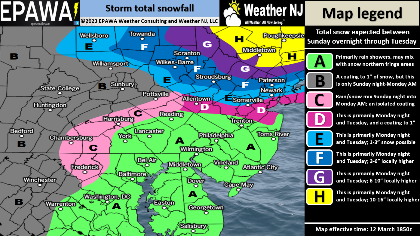
Please click here for full-resolution snow map!
In English: Lighter snow/rain moves in between Monday morning and afternoon and sets up a snow/rain line near I-80/I-287). The snow/rain line then crashes through all of NJ between late Monday night and Tuesday noon while snowfall rates intensify. It then snows for most of Tuesday ending later Tuesday night. Winds and coastal flooding not too bad with this one. The above map represents our expected snow accumulation totals. We may update tomorrow or just roll with this one if models and live observations hold serve. The K-word is on standby for NNJ. It’s going to be hard to reach 12 inches given the lower snow ratios but not impossible. CNJ is looking a little snowier than yesterday but should still see a sharp cutoff in snow totals from N to S. SNJ will still likely battle warmer surface temperatures and walk away with little-to-no accumulation. Have a great rest of your Sunday and please be safe! JC
Premium Services
KABOOM Club offers inside info forecast discussion, your questions answered, and early storm impact maps (ahead of the public). At 99 cents per month, it’s an extremely feasible way to show support.
My Pocket Meteorologist (MPM), in partnership with EPAWA Weather Consulting, offers professional/commercial interests, whose businesses depend on outdoor weather conditions (snow plowing, landscaping, construction, etc.), with hyper-local text message alerts/forecasts and access to the MPM premium forum—the most comprehensive and technical forecast discussion available for PA and NJ.
Jonathan Carr (JC) is the founder and sole operator of Weather NJ, New Jersey’s largest independent weather reporting agency. Since 2010, Jonathan has provided weather safety discussion and forecasting services for New Jersey and surrounding areas through the web and social media. Originally branded as Severe NJ Weather (before 2014), Weather NJ is proud to bring you accurate and responsible forecast discussion ahead of high-stakes weather scenarios that impact this great garden state of ours. All Weather. All New Jersey.™ Be safe! JC


LOCAL FORECAST | INTERACTIVE RADAR | LATEST NJ WEATHER ALERTS | WEDDING FORECAST| PRIVACY POLICY
© Copyright 2026 Weather NJ LLC. All Rights Reserved.
Some information that can be found on our website is provided by a private weather station and is not an officially recognized station for weather reporting. Though we always strive to achieve accurate reporting for our own use, it is important that you do NOT depend on the data provided here for any purpose.
