

Snow Tonight fo NNJ/CNJ
Discussion: We have a few things to talk about. Many are ready for spring weather conditions and all the activities that accompany such. The snow lovers however are in denial at this point evident by the many “I will believe it when I see it” comments. I understand the frustration, as a snow lover myself, but mother nature rarely listens to flat associations made from the recent past about the near future. One of my weather mentors is best known for the quote, “It’s going to snow where it wants to snow” and it has never failed yet lol. The truth is we’re heading into the best snow-looking pattern of the winter in the last 2 calendar weeks of winter. The Sudden Stratospheric Warming Event a few weeks ago has made it down to the surface for lower latitudes. We won’t be taking an Arctic invasion to the face like we saw around Christmas time or a few weeks ago. But we will have some Arctic forces attempting to squash the warm SE US ridge for the period of March 12-22. During this time, quite a few synoptic storm signals are likely including coastal storm systems. I am really only interested in the March 12-13 signal at this time but that only opens the door to the pattern that should end around the equinox. The March 22 date marker will likely be the close of this pattern window.
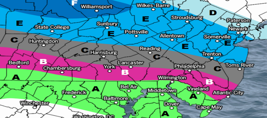
Either way, we should have an interesting end to winter and it begins tonight with a light clipper-like storm system that should push through from NW to SE. The system is favoring the area between I-195 and I-80 for a very thin jackpot zone. This has high bust potential as any slight variations N or S could mean the jackpot sways 20-30 miles N or S across NJ. Lighter snow however could also push into extreme NENJ and as far S as N parts of SNJ. The general idea is that this initially starts colder for NNJ then temps drop from NNJ to SNJ as the precipitation moves through. So NNJ would be more of an all snow event while areas further S in CNJ/SNJ would start as rain and end as snow. Here is our impact map for snow/rain expected to fall between midnight tonight and sunrise tomorrow morning.
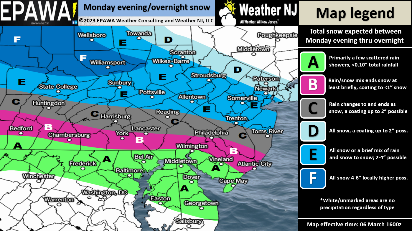
Click for full-resolution snow map!
Monday (March 6) high temperatures should reach near-50 for most areas, maybe low-to-mid 50s due to drier air. Skies should be mixed with sun and clouds with increasing cloud coverage heading into overnight hours. Snow/rain is expected to move into NNJ/SNJ overnight and fall between midnight and sunrise Tuesday. See the above snow map for more details. Winds should be light out of the W/NW. Overnight lows should range from upper-20s to upper-30s as some light snow tries to fall overnight.
Tuesday (March 7) high temperatures should eventually reach the low-to-mid 40s in the afternoon. But not before some snow and rain falls during early AM hours when it’s still cold enough for NNJ, and possibly parts of CNJ, to stick. SNJ likely a cold rain. See the above snow map for more details about expected amounts. It should clear out by sunrise if not slightly earlier. But many in NNJ/CNJ could wake to some snowy scenery Tuesday morning. Road crews should have no problem clearing it with maybe some delays but no need for closures IMO. Winds should become breezy later in the day, gusty at times, out of the NW. Overnight lows should range from mid-20s to lower-30s with NW winds remaining stiff.
Wednesday (March 8) high temperatures should reach the low-to-mid 40s. Skies should be mixed with sun and clouds. Winds should remain breezy/gusty out of the NW. Overnight lows should fall to near-30 for most areas.
Thursday (March 9) high temperatures should reach the mid-to-upper 40s for most areas. Skies should be mostly sunny. Winds should be light-to-breezy out of the N/NW. Overnight lows should range from 20-30 from elevations to coasts.
Friday (March 10) high temperatures should reach the mid-to-upper 40s for most areas. Skies should transition from mostly clear to cloudy throughout the day. Winds should be light out of the W/NW. Overnight lows should range from 30-40 with precipitation moving in, possibly as snow for N/NW points.
An early look at the weekend indicates tremendous uncertainty. The models are picking up on the start of a stormy pattern favorable for snow but are having trouble getting a handle on it this far out. A March 12-13 storm signal would be the first of many in the general March 12-22 period. I will report accordingly. The temperature profile for this weekend through that period looks cold for March…highs staying in the mid-to-upper 30s with overnight lows down into the 20s…certainly cold enough for snow. Let’s see how it unfolds this week. Have a great week and please be safe! JC
Premium Services
KABOOM Club offers inside info forecast discussion, your questions answered, and early storm impact maps (ahead of the public). At a buck per month, it’s an extremely feasible way to show support.
My Pocket Meteorologist (MPM), in partnership with EPAWA Weather Consulting, offers professional/commercial interests, whose businesses depend on outdoor weather conditions (snow plowing, landscaping, construction, etc.), with hyper-local text message alerts/forecasts and access to the MPM premium forum—the most comprehensive and technical forecast discussion available for PA and NJ.
Jonathan Carr (JC) is the founder and sole operator of Weather NJ, New Jersey’s largest independent weather reporting agency. Since 2010, Jonathan has provided weather safety discussion and forecasting services for New Jersey and surrounding areas through the web and social media. Originally branded as Severe NJ Weather (before 2014), Weather NJ is proud to bring you accurate and responsible forecast discussion ahead of high-stakes weather scenarios that impact this great garden state of ours. All Weather. All New Jersey.™ Be safe! JC


LOCAL FORECAST | INTERACTIVE RADAR | LATEST NJ WEATHER ALERTS | WEDDING FORECAST| PRIVACY POLICY
© Copyright 2026 Weather NJ LLC. All Rights Reserved.
Some information that can be found on our website is provided by a private weather station and is not an officially recognized station for weather reporting. Though we always strive to achieve accurate reporting for our own use, it is important that you do NOT depend on the data provided here for any purpose.
