

Still watching Sunday rain (July 20)
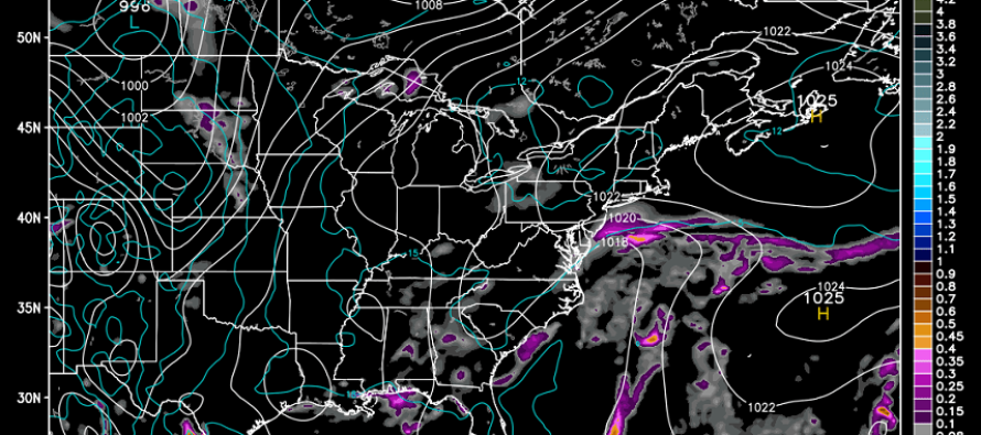
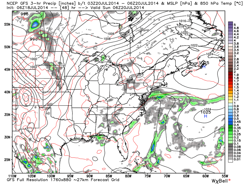
Today and tomorrow will continue to feature weather to die for. Highs will max out in the lower 80s with lows ranging from 58-64 (NWNJ-SENJ) under a mixed bag of mostly sun and clouds. I’m still monitoring Sunday for a potential low-impact event SE of the I-95 corridor. The GFS continues to show weak low pressure paralleling the coast and interacting with high pressure over Bermuda. This could possibly bring rain to the shore early Sunday morning and throughout the day. The good news is that impacts have trended lighter and further SE than yesterday’s GFS solution. This slide is for 2AM Sunday morning. To me this looks like overcast skies/possible sprinkles and only along coastal/SENJ areas.
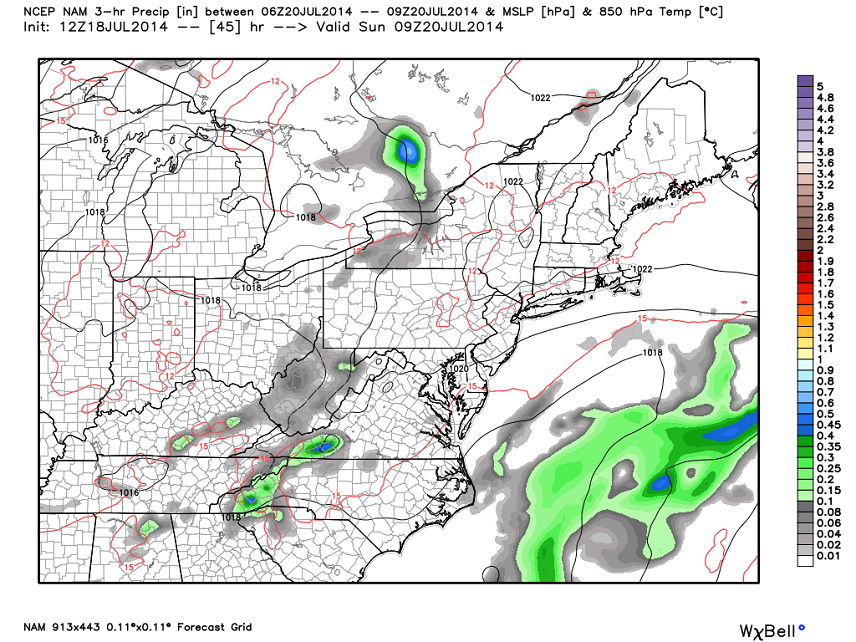
Now that we’re within 48 hours, shorter range models such as the NAM are starting to come into range. The NAM is spelling out a complete miss out to sea with a continuation of the current weather into next week. Here’s what the NAM says for 5AM Sunday morning:
The European model sides with the NAM for an out to sea solution under the assumption that the trough will keep the flow of moisture in check with drier air. The weak low pressure disturbance is still there just with it’s precipitation shield hindered in the NW quadrant. I think I’m starting to lean towards this solution as well. I have to assign a 25% chance of overcast skies with maybe even a sprinkle but that leaves a 75% chance for a beautiful day on Sunday. Here’s for hoping the latter verifies! Be safe and enjoy the rest of your weekend! JC
Jonathan Carr (JC) is the founder and sole operator of Weather NJ, New Jersey’s largest independent weather reporting agency. Since 2010, Jonathan has provided weather safety discussion and forecasting services for New Jersey and surrounding areas through the web and social media. Originally branded as Severe NJ Weather (before 2014), Weather NJ is proud to bring you accurate and responsible forecast discussion ahead of high-stakes weather scenarios that impact this great garden state of ours. All Weather. All New Jersey.™ Be safe! JC


LOCAL FORECAST | INTERACTIVE RADAR | LATEST NJ WEATHER ALERTS | WEDDING FORECAST| PRIVACY POLICY
© Copyright 2026 Weather NJ LLC. All Rights Reserved.
Some information that can be found on our website is provided by a private weather station and is not an officially recognized station for weather reporting. Though we always strive to achieve accurate reporting for our own use, it is important that you do NOT depend on the data provided here for any purpose.

)