

Storm Update and Future Snow Chat
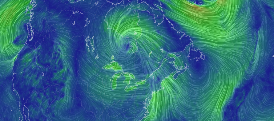
Discussion: The primary low in Canada is down to 978mb. Isobars are tightening and the attached cold front drapes all the way down into the SE US. High pressure is materializing over Oklahoma and will soon drift eastward, reinforcing the front with topside anti-cyclonic flow.
The rain is going about as expected. Some spots might eek out an inch of rain but otherwise most should fall short of such. We have about a few more hours of rain so expect it to end near sunset timing.
Wind has been gradually building out of the S and will now peak until about 7-8pm, especially along the SNJ/SENJ coasts. Current observations indicate widespread gusts to 30mph with NWNJ elevations and immediate coastal areas pushing on 40mph. Let’s allow about 5-10 more mph of wind gust increase before winds begin subsiding overnight into tomorrow.
No embedded thunderstorms or tornadoes so far and we probably won’t see such from this system. There still exists the possibility for localized damaging wind gusts given the surface pressure gradient stacked under the lower-level jet. But I think most wind gusts are going to be manageable. Winds will shift to the W/NW once the front crosses your location.
We’ll then dry out and chill down behind the cold front for all of Thursday and maybe into Friday morning. Then we’ll warm up again Friday PM into Saturday for another frontal rain system later Saturday. And then we cool back down for Sunday. Like I said earlier in this week’s outlook, a volatile week of ups and downs temp-wise.
Moving beyond this weekend, it’s hard not to get excited as a snow-lover myself. But I will try my best to present a non-biased viewpoint. Its important to note that I’m not seeing any one particular snowstorm on a specific date. What I am seeing is a favorable window of time opening up where snow could develop.
It all begins with the highly anomalous block to develop over Greenland by the Dec 5-7 period. This will give us the -NAO signal which will coincide with a -AO due to polar circulation relaxation. Again, this just initializes the pattern. I wouldn’t expect much snow-wise to happen in the Dec 5-10 period as we need time for the jet stream to buckle into the block and herniate into an E US trough of colder air mass. Smaller events here and there? Sure, why not? But we need a +PNA (ridge) to form in the W US to kick us into an active pattern, not just cold. But I am starting to think this will happen by the Dec 13-17 period given long-range cycle analysis. With that said, the Dec 13-17 is the first long-range snow signal I am watching of this rapidly approaching snow season. Again, we need a cold and active pattern for snow. We’ll turn colder with the Dec 5-7 pattern change but likely won’t become active until the following week. Fun times ahead!
In English: Temps will continue to roller coaster through this weekend. Mild, rainy, and windy today. Cold, dry, and windy tonight-tomorrow. Mild Friday into Saturday (more rain and wind Saturday like today). Then cold again Sunday. Next week, a colder pattern should set in and possibly set up a snowy pattern shortly after. It’s time folks. It’s time. Have a great rest of your Wednesday and please be safe! JC
Premium Services
KABOOM Club offers inside info forecast discussion, your questions answered, and early storm impact maps (ahead of the public). At a buck per month, it’s an extremely feasible way to show support.
My Pocket Meteorologist (MPM), in partnership with EPAWA Weather Consulting, offers professional/commercial interests, whose businesses depend on outdoor weather conditions (snow plowing, landscaping, construction, etc.), with hyper-local text message alerts/forecasts and access to the MPM premium forum—the most comprehensive and technical forecast discussion available for PA and NJ.
Jonathan Carr (JC) is the founder and sole operator of Weather NJ, New Jersey’s largest independent weather reporting agency. Since 2010, Jonathan has provided weather safety discussion and forecasting services for New Jersey and surrounding areas through the web and social media. Originally branded as Severe NJ Weather (before 2014), Weather NJ is proud to bring you accurate and responsible forecast discussion ahead of high-stakes weather scenarios that impact this great garden state of ours. All Weather. All New Jersey.™ Be safe! JC


LOCAL FORECAST | INTERACTIVE RADAR | LATEST NJ WEATHER ALERTS | WEDDING FORECAST| PRIVACY POLICY
© Copyright 2025 Weather NJ LLC. All Rights Reserved.
Some information that can be found on our website is provided by a private weather station and is not an officially recognized station for weather reporting. Though we always strive to achieve accurate reporting for our own use, it is important that you do NOT depend on the data provided here for any purpose.
