


Storms Around into Saturday. Sunday Gorgeous

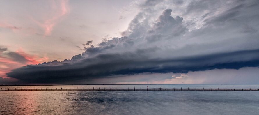
Discussion: The upper levels are indicating changes in the future pattern. While the overall pattern keeps the jet stream N of NJ (inducing ridges), I am seeing a few periods where the jet stream wants to dip to near or just S of NJ (baby troughs). We’re going to see one of those this Saturday into Sunday and then another at the end of next week. We’ll have to endure a hot buildup next week between those two periods of transient relief. As far as outdoor plans go this weekend, I know it’s frustrating (for me too). Tonight is going to be stormy with on and off downpours around. Saturday is not a stormy all day scenario. Saturday storms should congeal into a linear segment that bows or pushes through NJ from NW to SE between noon and 5pm…with an actual local impact time of an hour or less. Sure, it could look scary watching the shelf clouds come in while getting everyone to safety. It could be annoying trapped inside with heavy downpour outside. But when rain tapers off, it’s going to be back to a nicer summer day feel (with wet grounds). So, it’s your call how you adjust your plans based on what you got going on. A pool party with shelter space can make different decisions than an outdoor unprotected cotton candy sculpture contest. But what I’m seeing is a nasty hour or two max (sometime between noon and 5pm (NWNJ to SENJ)) nested within an okay day otherwise…humid with more clouds than sun before the storms and drier feeling with more sun than clouds after. And since there is a cold front pushing these storms through, it should feel miraculous later outside Saturday night. Maybe a little breezy but comfortable. Sunday is then clearly the best day of the weekend as humidity will be temporarily cleared out to sea with the cold front leaving average summer temperatures and great conditions behind over NJ. Next week we will be back to 90s with humidity. Hot but not as hot as last week. More thunderstorms will be possible, especially towards the end of the week to break the heat and humidity again.
And then July 20 or after, I’ll be looking forward to the first solid cold front that 1) Reminds us what half of the year we’re now in and 2) Temporarily takes us from mid-summer feel to late-summer/early-fall feel. This typically happens as early as late-July but sometimes not until mid-August. Don’t get me wrong, lots of hot days to go. But at some point in that window, during a transient post-cold front period, we’ll wake up one morning and say “ooh, fall is just around the corner.” …like those first few seconds of initial descent from cruising altitude on an airplane that lets you know you’re not far from your destination. The captain usually comes on around that time and reminds everyone about seatbelts and sometimes provides a destination weather report.” You get the picture. Then as the cooler times transition from transient to prolonged, and the 90+ times transition from prolonged to transient (Aug into first week of Oct), we’ll watch the tropics and anticipate winter 2026-2027.
Forecast
Friday (July 10) high temperatures are as warm as they’re going to get (as of Friday 4pm) with most of NJ in the 80-85 range and dew points in the 70s (humid). Skies are mixed with mostly clouds and a few isolated thunderstorm cells out ahead of the more concentrated storm batch. I expect the main storm batch to roll through between now and later tonight…sort of like yesterday. Damaging winds and flooding rains are possible from individual cells if they can grow enough. Otherwise just garden variety thunderstorms. It should all clear through midnight or so. Another muggy evening on-deck though with a humid/stormy feel and most NJ temperatures staying above 70 with the exception of NNJ elevations dipping into the 60s.
Saturday (July 11) high temperatures should reach the 80-85 range for most of NJ. Skies should be mixed with sun and clouds with more thunderstorms around and a humid feel. It looks like thunderstorms want to form a linear segment that pushes through all of NJ from NW to SE between the hours of noon and 5pm. Actual storm impact time (first drops to last drops) would be an overall period of 1-2 hours somewhere within that noon to 5pm window depending on your location. During this time, damaging wind gusts and flooding rainfall could occur since the atmosphere is still juiced. Conditions then look to improve after that with only super isolated cells around if any. Winds should be light out of the N/NE otherwise (when not under/near a thunderstorm). Overnight lows should fall back to the 60-70 range with a few more very isolated showers and thunderstorms possible into Sunday morning.
Sunday (July 12) high temperatures should reach the 80-85 range but with a noticeably less humid feel. Skies should be mostly sunny. Winds should be light out of the NE (slightly breezier along the coast). Overnight lows should fall to the 58-65 range NNJ to SNJ. Should feel great with the lower humidity.
An early look at next week (July 13-17) indicates 90s returning for another heat wave. It won’t be like last week but will be hot and humid enough to justify complaint and re-enable heat exhaustion/heat stroke safety concerns. As I wrote about last week, I am watching for any “ring of fire” storm chances in the general Monday-Thursday period. Though it now looks like it would more in the Wed-Thurs period of those 4 days with Mon-Tues warm/hot but storm-free. Will continue to monitor. But what can be confidently said is that next week looks summery and typical for time of year with no large scale storm systems currently expected. I will continue to monitor storms this evening and tomorrow and will report accordingly. Have a great weekend and please be safe! JC
Premium Services
KABOOM Club offers an ad-free environment, inside info (Above and Beyond) forecast discussion, your questions prioritized, and early storm impact maps and video releases (ahead of the public). At $1.99 per month, it’s an extremely feasible way to show additional support for Weather NJ and you can turn it on and off for however many months you wish. Think of it as a tip jar with perks. Available onFacebook or Patreon.
My Pocket Meteorologist (MPM), in partnership with EPAWA Weather Consulting, offers professional/commercial interests, whose businesses depend on outdoor weather conditions (snow plowing, landscaping, construction, etc.), with hyper-local text message alerts/forecasts from real meteorologists and access to the MPM premium forum—the most comprehensive and technical forecast discussion available for PA and NJ commercial interests.
KABOOM Shop is live if you want some KABOOM or Weather NJ Merch!

Jonathan Carr (JC) is the founder and sole operator of Weather NJ, New Jersey’s largest independent weather reporting agency. Since 2010, Jonathan has provided weather safety discussion and forecasting services for New Jersey and surrounding areas through the web and social media. Originally branded as Severe NJ Weather (before 2014), Weather NJ is proud to bring you accurate and responsible forecast discussion ahead of high-stakes weather scenarios that impact this great garden state of ours. All Weather. All New Jersey.™ Be safe! JC



LOCAL FORECAST | INTERACTIVE RADAR | LATEST NJ WEATHER ALERTS | WEDDING FORECAST| PRIVACY POLICY
© Copyright 2026 Weather NJ LLC. All Rights Reserved.
Some information that can be found on our website is provided by a private weather station and is not an officially recognized station for weather reporting. Though we always strive to achieve accurate reporting for our own use, it is important that you do NOT depend on the data provided here for any purpose.

