

Storms Expected Tomorrow (July 27)
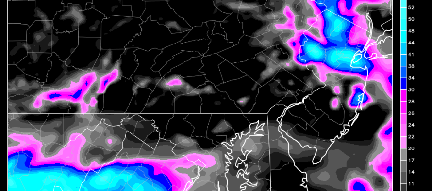
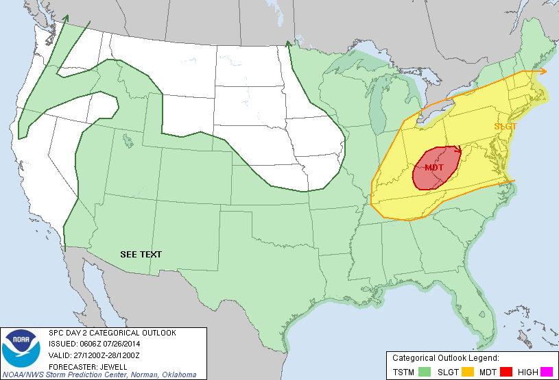
Some unexpected nuisance clouds and rain showers are moving across the region this morning. They should clear to the east and still allow a nice day from noon-forward. There’s nothing even remotely severe about them so again, just a nuisance. Tomorrow is a different story as short range guidance is suggesting strong to severe thunderstorms moving through the region. The National Weather Service’s Storm Prediction Center is indicating the entire state of New Jersey in a SLGT risk area tomorrow. That gives us about a 30% chance of severe weather occurring:
Basically another one of those cooler air-masses is approaching the region. This is due to a large trough swinging through the eastern 2/3 of the US, just like last week. The leading edge of this trough is what will cause tomorrow’s disturbances. Winds higher in the atmosphere will be moving very fast above that leading edge of the trough. This is called a strong mid-to-upper jet. So we have a hot-cold conflict in temperature coupled with high winds aloft. Should enough lower-level disturbance occur, it could bring those upper winds down to to the surface. With that being said, isolated instances of wind damage are very possible tomorrow.
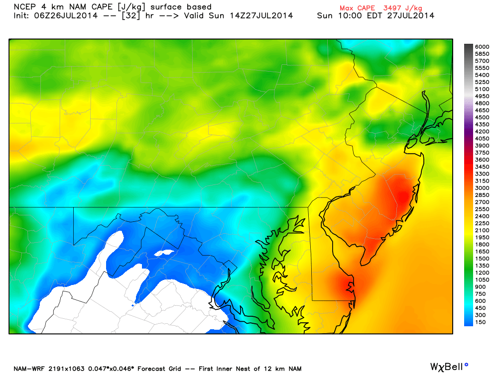
Now let’s talk instability. I’m seeing a surge of surface-based CAPE (Convective Available Potential Energy) moving from SNJ in the morning through NNJ in the afternoon. This should pretty much keep the entire day unsettled tomorrow as storms will be possible at any time. This is the high-res 4km NAM showing 3000 j/kg (joules per kilogram) of surface-based CAPE in SNJ at 10AM tomorrow morning. Mixed-layer CAPE is impressive as well which indicates deep-layer instability:
In English: Nuisance showers will clear and salvage a nice afternoon-evening today. Tomorrow has storm possibilities for most of the day. It’s not like we have a small 1 hour window of storm passage. The best trend I can assign to tomorrow is a better chance for SNJ the first half of the day and then NNJ the second half. So at times expect heavy downpours of rain, gusty winds, lightning, and possibly hail. While not storming, I’d expect a mixed bag of sun and clouds with generally muggy conditions. I’d say the overall hit or miss chances tomorrow are 50/50. There will be storm fans/non-storm fans both disappointed and pleased depending on how it geographically plays out. I’ll be tracking. Be safe! JC
Jonathan Carr (JC) is the founder and sole operator of Weather NJ, New Jersey’s largest independent weather reporting agency. Since 2010, Jonathan has provided weather safety discussion and forecasting services for New Jersey and surrounding areas through the web and social media. Originally branded as Severe NJ Weather (before 2014), Weather NJ is proud to bring you accurate and responsible forecast discussion ahead of high-stakes weather scenarios that impact this great garden state of ours. All Weather. All New Jersey.™ Be safe! JC


LOCAL FORECAST | INTERACTIVE RADAR | LATEST NJ WEATHER ALERTS | WEDDING FORECAST| PRIVACY POLICY
© Copyright 2026 Weather NJ LLC. All Rights Reserved.
Some information that can be found on our website is provided by a private weather station and is not an officially recognized station for weather reporting. Though we always strive to achieve accurate reporting for our own use, it is important that you do NOT depend on the data provided here for any purpose.

)