

Strong Storm Developing for New Jersey
Discussion: We’re still looking at a cold weekend. Current N/NW flow behind the departing ocean storm will pull Arctic air back over NJ tonight through early Sunday morning. It looks like no one will make it above freezing on Saturday for a high temperature. Some locations might struggle to break out of the teens. Tonight and tomorrow night will obviously be even colder than that.
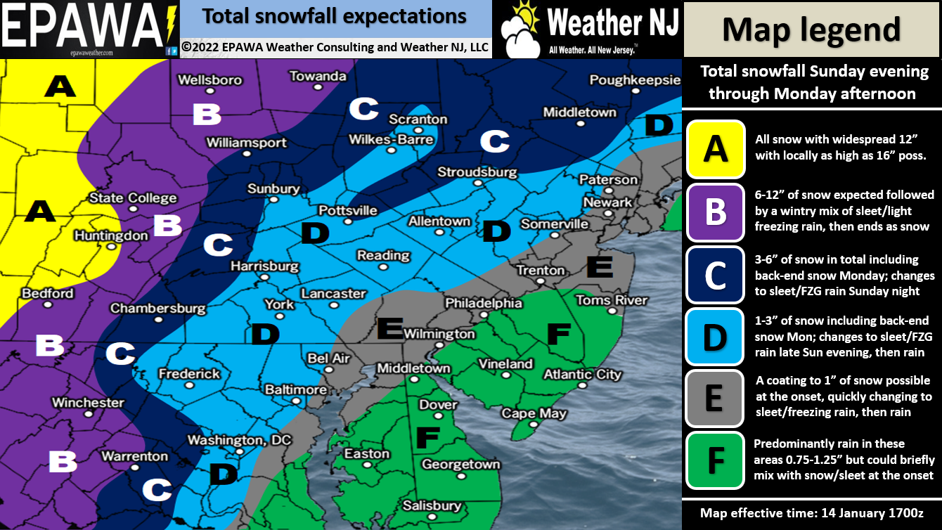
We then turn all eyes towards a powerful storm system moving through Sunday night into Monday. An upper-level low will form in the S/C and interior SE US and be influenced by a trailing N stream of energy. Models are converging on a low track either right along or just inside the east coast (basically over NJ or just NW of NJ). This would mean snow to start followed by a transition to sleet and then plain rain for most (good chance). Any snow from this system will occur at the onset of precipitation, not in the middle or end.
A decent amount of front-end snow could still dump, especially for NWNJ elevations before changing over. And NWNJ might only change to a mix at times instead of plain rain (low chance). But it looks like no areas of NJ will stay all snow. SENJ has the best chance to get roasted out from the strong expected marine flow coming from the warmer above-freezing Atlantic Ocean. So SENJ would drive above freezing first and NWNJ would do so last.
This is only the second signal in the upcoming active pattern which should last into February. Our snow map below represents how much snow should fall before the changeover but the main headline of this event will be wind IMO. We will have a rapidly deepening low track through NJ. On the N/NE side of that low will be powerful E/SE flow right into NJ late Sunday night into Monday morning. Sustained winds of 30-40mph with gusts to 60+ are not off the table in that period, especially for the ECNJ/SENJ coast. Once the low moves through, Winds will switch from onshore to NW or W/NW.
With the high wind threat comes the likelihood of power outages and coastal flooding potential. We have a full moon Monday, possibly 1-2 inches of rainfall dumping in a short period, and the wind-driven storm surge potential. ECNJ and SENJ coastal areas really need to pay attention to the high tides that occur between late Sunday night and Monday morning (whatever the next high tide is after that on Monday). A saving grace would be if the strongest wind-driven storm surge occurs during your low astronomical tide. Tides vary by region.
Either way, here is our expected snow map…again for front end snow that will likely be melted by following warmer temps and rain. NWNJ would stay the coldest the longest:
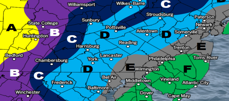
Full resolution snow impact map.
In English: After a very cold Friday night through Saturday night (well below freezing), winds will become onshore Sunday morning and begin warming ECNJ/SENJ. As the day progresses winds will gradually pick up and more of NJ will warm above freezing at the surface. Precipitation should break out by Sunday evening/night and dump until about sunrise Monday morning. NWNJ has the best chance to start as snow and accumulate before any changeovers to ice/rain occur. Everyone along the turnpike and SE of such will struggle to accumulate snow if any. Again, NWNJ has best chance to stack some snow inches before the transition. Winds are a much higher concern of mine. Expect gusty (possibly damaging) winds along the immediate ECNJ/SENJ coast and possibly further inland. Please secure all small human beings. These winds should correlate with the heavy rainfall Sunday night into Monday morning. There’s a small chance this comes a little east still for a colder solution but it’s not looking that way as of now. We’ve seen some systems slip to the E in the past (Nov 2012 after Sandy, Jan 2015 blizzard, Hermine in 2016) which is always possible with so many moving parts involved. But the data does not currently suggest that. At this point the question is… does significant snow make it down to the turnpike/95 corridor? Or does it stay in the NWNJ elevations. Also, how much ice is going to fall instead of snow or rain given the cold aloft, torchy low-mid levels, and cold initial surface NW of the turnpike. Still some uncertainty but starting to see writing on the wall. Tomorrow is another day to refine the forecast. Have a great rest of your Friday, enjoy the weekend, and please be safe! JC
Download the free Weather NJ mobile app on Apple or Android. It’s the easiest way to never miss Weather NJ content. Our premium services go even further above and beyond at the hyper-local level.
Jonathan Carr (JC) is the founder and sole operator of Weather NJ, New Jersey’s largest independent weather reporting agency. Since 2010, Jonathan has provided weather safety discussion and forecasting services for New Jersey and surrounding areas through the web and social media. Originally branded as Severe NJ Weather (before 2014), Weather NJ is proud to bring you accurate and responsible forecast discussion ahead of high-stakes weather scenarios that impact this great garden state of ours. All Weather. All New Jersey.™ Be safe! JC


LOCAL FORECAST | INTERACTIVE RADAR | LATEST NJ WEATHER ALERTS | WEDDING FORECAST| PRIVACY POLICY
© Copyright 2026 Weather NJ LLC. All Rights Reserved.
Some information that can be found on our website is provided by a private weather station and is not an officially recognized station for weather reporting. Though we always strive to achieve accurate reporting for our own use, it is important that you do NOT depend on the data provided here for any purpose.
