

Strong Winds Expected Thursday
Discussion: The warm front is just about through. We’ll cool some tonight but it won’t be like the last few nights. Tomorrow looks very mild with temps likely reaching 70 or greater for most areas. Skies should be mixed with mostly clouds and some sun. It should feel very unsettled and for good reason. Showers could break out at any time ahead of the main storm front later. NJ will be in the warm sector where winds are expected to rip pretty good.
Winds should pick up tomorrow from about noon-forward. I’m expecting gusts of 30-45mph out of the S/SW from about noon until the storm front moves through. It is important to separate these synoptic scale winds, that should occur for most of the afternoon/evening from the winds associated with any localized severe thunderstorm instances. The latter is capable of producing the highest wind gusts.
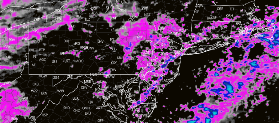
The storm front(s) – there could be a few waves – should push through NJ from W to E between early evening Thursday night and early Friday morning. Right now it looks like WNJ is favored for harder storms than ENJ with typical fizzling likely with loss of sunlight and marine influence. But again, rain showers are possible all-day Thursday in the ripping warm sector. It might be the early hours of Friday morning that the worst winds and thunderstorms come through. It depends how the precipitation and energy separates along with the separation of the lows. The S low should pass right over NJ which could enhance lifting and winds. For these reasons, you can’t rule out the chance for a tornado, especially for CPA/EPA/WNJ where the dynamics will be greater.
Friday into the weekend still looks to improve with dry conditions. But the chilly theme remains with highs likely capped at 55-60 and overnight lows still into the 30s. It should feel okay considering the recent cold but not quite as mild as you’d like it to be. First part of April still looks chilly as well. Transient warmth and prolonged cold. Sustainable warmth not in sight for probably at least 1-2 weeks.
In English: Thursday will be very mild compared to recent cold days. Winds should pick up around noon and persist through the afternoon evening with gusts of 30-45mph out of the SW. Then a series of storms will push through from W to E between Thursday evening and early Friday morning. These storms could produce heavy downpours and wind gusts to 60mph. Tornado not off the table. But once the storms are through, the winds should relax for the weekend. The weekend looks dry and chilly but sunny daytime hours should feel nice after recent cold. Have a great rest of your Wednesday and please be safe! JC
Premium Services
KABOOM Club is more for the snow lover or weather nerd who needs inside info with early forecast discussion and storm impact maps (ahead of the public). It’s a bit more complex than what the public sees but offers the “In English” with it. It’s also a way to support Weather NJ with a 99-cent per month contribution.
My Pocket Meteorologist offers commercial interests, whose businesses depend on outdoor weather conditions (snow plowing, landscaping, construction, etc.), with hyper-local text message forecasts and access to the My Pocket Meteorologist premium forum. This information is the most complex analysis available as needed by the outdoor commercial sector.
Jonathan Carr (JC) is the founder and sole operator of Weather NJ, New Jersey’s largest independent weather reporting agency. Since 2010, Jonathan has provided weather safety discussion and forecasting services for New Jersey and surrounding areas through the web and social media. Originally branded as Severe NJ Weather (before 2014), Weather NJ is proud to bring you accurate and responsible forecast discussion ahead of high-stakes weather scenarios that impact this great garden state of ours. All Weather. All New Jersey.™ Be safe! JC


LOCAL FORECAST | INTERACTIVE RADAR | LATEST NJ WEATHER ALERTS | WEDDING FORECAST| PRIVACY POLICY
© Copyright 2026 Weather NJ LLC. All Rights Reserved.
Some information that can be found on our website is provided by a private weather station and is not an officially recognized station for weather reporting. Though we always strive to achieve accurate reporting for our own use, it is important that you do NOT depend on the data provided here for any purpose.
