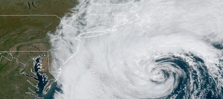
Subtropical Storm Melissa Departs (Oct 12-14)

Discussion: Our offshore storm system has been named Subtropical Storm Melissa. Quite honestly she has worn out her welcome especially for coastal residents. She is still providing elevated tides and even a few fringe showers to extreme ECNJ/SENJ today. Melissa will continue to pull away to the E and be far enough away Saturday for the coastal flooding threat to subside. Tonight (Friday) should be the last high tide of concern. Please use caution and don’t drive through the water. It is salty water not fresh rain water. Some more rain is possible on Sunday especially for afternoon-evening hours. Upper-levels then look rather boring until about Wednesday night when a colder trough is expected to move in. That means at least Thursday-Friday should see below-average temperatures. We’re talking highs in the upper-50s/lower-60s with colder overnight hours. The longer-range storm signal has evolved into just a passing progressive rain system midweek for us. The actual storm signal was for real though and will likely develop into a much stronger system for the NorthEast US. We might see some back-end winds from it. No other concerns remain on the horizon. Just stay out of the water in extreme ECNJ/SENJ.
Friday (Oct 11) high temperatures should top out in the low-to-mid 60s for most areas. SWNJ closer to 70. Skies should be mostly cloudy for ENJ. A few showers possible for immediate coast from offshore storm system Melissa. Coastal flooding is still a concern for barrier islands and immediate coastal areas in ECNJ/SENJ. Friday evening’s high tide should be the last of concern. WNJ the best chance for cloud breakage. Winds should be light-to-breezy out of the N/NE. Overnight lows should range from mid-40s to lower-50s NNJ to SNJ.
Saturday (Oct 12) high temperatures should reach the upper-60s for most areas. Maybe near-70 in SNJ. Skies should be mixed with sun and clouds. Winds should be light out of the W/NW. Overnight lows should range from lower-40s to lower-50s NNJ to SNJ.
Sunday (Oct 13) high temperatures should reach the mid-to-upper 60s for most areas. Skies should gradually increase in cloud coverage. Rain is possible for afternoon-evening hours. Winds should be light out of the E. Overnight lows should range from mid-40s to upper-50s NNJ to SNJ.
An early look at next week indicates average fall temperatures to start and slightly below-average temperatures as we get closer to the weekend. A mixed bag of sun, clouds and showers. Let’s take a closer look on Sunday. Have a great weekend and please be safe! JC
Download the new free Weather NJ mobile app on Apple and/or Android. It’s the easiest way to never miss Weather NJ content. Our premium services go even further above and beyond at the hyper-local level. Looking for industrial-caliber long-range forecasting data that I personally recommend? Check out WeatherTrends360!
Jonathan Carr (JC) is the founder and sole operator of Weather NJ, New Jersey’s largest independent weather reporting agency. Since 2010, Jonathan has provided weather safety discussion and forecasting services for New Jersey and surrounding areas through the web and social media. Originally branded as Severe NJ Weather (before 2014), Weather NJ is proud to bring you accurate and responsible forecast discussion ahead of high-stakes weather scenarios that impact this great garden state of ours. All Weather. All New Jersey.™ Be safe! JC


