

The Brutal Cold Continues (Feb 17-20)
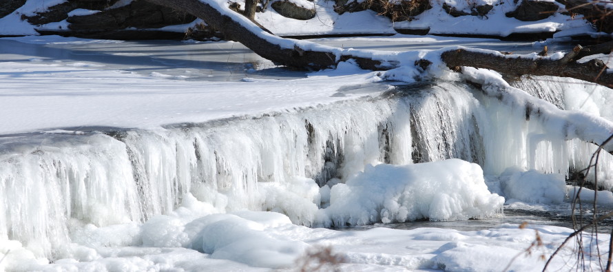
Today and tomorrow will remain slightly unsettled but the brutal cold returns to close out the week with more of the same next week. It looks like we stay below freezing (even for highs) through at least Saturday morning. Let’s break it down:
Tuesday will fail to escape the 20s for highs statewide. Remnant snow showers are possible which can temporarily limit visibility so please be careful if you get hit with one, especially when driving. There are a few in NNJ/CNJ as I type this now. Other than that expect a mixed bag of mostly clouds and some sun. Winds will be stiff out of the N at 10mph with gusts to 20mph. Overnight lows should then drop into the single digits.
Wednesday will also fail to escape the 20s for highs statewide. Expect another mixed bag of mostly clouds and some sun. Snow showers and squalls are possible, especially later in the evening with a sneaky little disturbance rolling through. Winds should be otherwise tranquil. Overnight lows then drop into the teens as any snow showers or squalls taper off by Thursday morning.
Thursday highs will fail to escape the teens statewide. An Arctic front will bring drier and clearer skies but winds will be strong out of the NW, especially behind the front. Expect sustained NW winds of 15-20mph with gusts to 30mph. Overnight lows then fall to about zero.
Friday highs will also fail to escape the teens statewide. There should be plenty of sunshine but strong NW winds will hold and keep the wind chills brutal. Overnight lows should then fall into negative territory for most of the state with maybe SENJ staying slightly above zero.
An early look at the weekend suggests another possible wintry event but I’m only watching guidance. No forecast yet. We should finally poke our head above freezing Saturday and Sunday during afternoon highs—should feel like a beach day! Colder than average temperatures are expected to return again for next week.
This Tuesday-Friday Outlook is proudly sponsored by weathertrends360 (www.weathertrends360.com). Through 150 years of world wide weather data analysis, weathertrends360 has developed proprietary algorithms and methods that predict weather up to a year with 84% accuracy. They are second to none in the long range so check them out for business planning, travel planning, etc.
Be safe! JC
Jonathan Carr (JC) is the founder and sole operator of Weather NJ, New Jersey’s largest independent weather reporting agency. Since 2010, Jonathan has provided weather safety discussion and forecasting services for New Jersey and surrounding areas through the web and social media. Originally branded as Severe NJ Weather (before 2014), Weather NJ is proud to bring you accurate and responsible forecast discussion ahead of high-stakes weather scenarios that impact this great garden state of ours. All Weather. All New Jersey.™ Be safe! JC


LOCAL FORECAST | INTERACTIVE RADAR | LATEST NJ WEATHER ALERTS | WEDDING FORECAST| PRIVACY POLICY
© Copyright 2026 Weather NJ LLC. All Rights Reserved.
Some information that can be found on our website is provided by a private weather station and is not an officially recognized station for weather reporting. Though we always strive to achieve accurate reporting for our own use, it is important that you do NOT depend on the data provided here for any purpose.

)