

Thunderstorms Approaching!
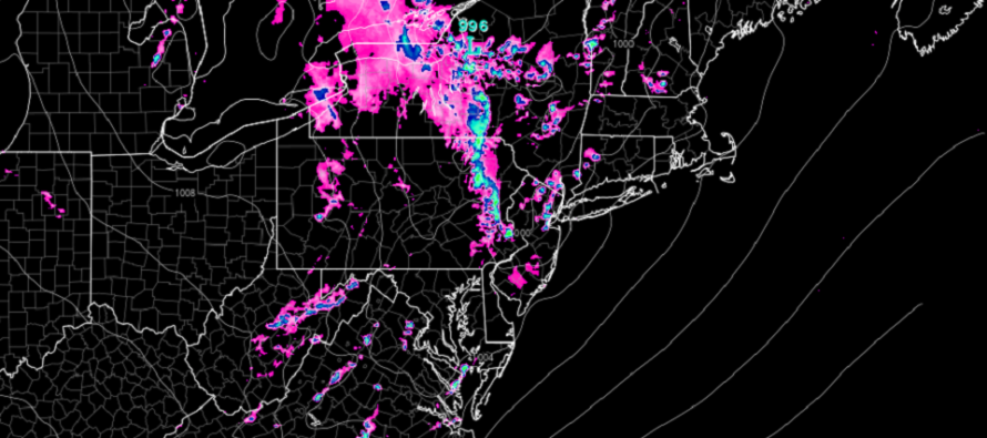
Discussion: A quick glance at the radar indicated that the storm front is knocking on NWNJ’s door. A few smaller cells have formed today for NJ, ahead of this storm front, but were non-severe and ended up fading out. The northern part of the storm front will push through all of NJ, after NWNJ, as it generally whip-cracks and feeds into the low in NY State (where the most intense dynamics are).
The southern part of the storm front is still forming in SEPA and will push through NJ last later this evening. It looks like areas N and W of 95 will see stronger storms than areas S and E of 95. That’s not to say that SENJ will miss the storms. That’s just to say there are better dynamics over the NW part of NJ than the SE parts. SENJ is used to fizzling storm fronts by now due to marine air stabilization of air and loss of sunlight.
So areas along and NW of 95 are looking at thunderstorm impacts over the next few hours (likely stronger storms). Areas SE of 95 are looking at more of a 5-8pm window of timing (likely weaker storms).
The most likely conditions are a short period of heavy rain, gusty winds, lightning, and maybe some smaller hail. The slightly less likely (but still a good chance) conditions are severe criteria wind (58mph+) and hail criteria. The least likely scenario is a tornado but that’s not off the table. With a congealed storm front, tornadoes are less likely vs independent supercells. I’m not fully sold on tornadoes for NJ tonight but it’s never safe to ignore even a small possibility.
But otherwise, this should push through and then we gradually warm this week heading into the weekend as a ridge develops for the E US.
In English: It’s showtime. NWNJ first (now through 5pm) and SENJ last (5-8pm). The strongest storms of the storm front should occur for NWNJ, the weakest for SENJ. But all of NJ is on the hook for a storm front to push through this afternoon-evening. Expect heavy rain, gusty winds, possible hail, and a small chance of tornado. It should only be an hour or less of such impacts from when the storm arrives to clearing your specific location. Have a great night and please be safe! JC
Premium Services
KABOOM Club offers inside info forecast discussion, your questions answered, and early storm impact maps (ahead of the public). At a buck per month, it’s an extremely feasible way to show support for JC.
My Pocket Meteorologist (MPM), in partnership with EPAWA Weather Consulting, offers professional/commercial interests, whose businesses depend on outdoor weather conditions (snow plowing, landscaping, construction, etc.), with hyper-local text message alerts/forecasts and access to the MPM premium forum—the most comprehensive and technical forecast discussion available for PA and NJ.
Jonathan Carr (JC) is the founder and sole operator of Weather NJ, New Jersey’s largest independent weather reporting agency. Since 2010, Jonathan has provided weather safety discussion and forecasting services for New Jersey and surrounding areas through the web and social media. Originally branded as Severe NJ Weather (before 2014), Weather NJ is proud to bring you accurate and responsible forecast discussion ahead of high-stakes weather scenarios that impact this great garden state of ours. All Weather. All New Jersey.™ Be safe! JC


LOCAL FORECAST | INTERACTIVE RADAR | LATEST NJ WEATHER ALERTS | WEDDING FORECAST| PRIVACY POLICY
© Copyright 2026 Weather NJ LLC. All Rights Reserved.
Some information that can be found on our website is provided by a private weather station and is not an officially recognized station for weather reporting. Though we always strive to achieve accurate reporting for our own use, it is important that you do NOT depend on the data provided here for any purpose.
