

Thunderstorms Approaching Jersey
Discussion: With actual temps over 90 for most of NJ and dew points well into the 70s, most of NJ is sitting with a heat index of ~100-110 less Sussex County…as of about 4pm. I’m seeing some high levels of Convective Available Potential Energy (CAPE) at the surface and mixed layers. Lifted Index is almost -10 in some locations. This tells me that the atmosphere is very buoyant and supportive of lifting air (destabilized).
The soundings also indicate marginal-to-adequate wind shear values to support thunderstorm development and maintenance as a linear stormfront. No capping inversion is present which tells me there is little to prevent thunderstorm development along and ahead of the stormfront.
A cold front is draped across SWPA to NEPA into New England but it appears a pre-frontal trough is trying to run ahead of it as a stormfront for NJ this evening. Both features depending on the angle they zip up towards NJ have lifting trigger potential once they push through NJ. These are all the main ingredients for a classic mid-summer stormfront that should push through NJ from W to E this evening between about 5pm and 9pm.
Given the higher Precipitable Water (PWAT) values, the downpours of rain should be more than capable of producing localized flash flooding. I don’t need to tell you how humid it feels outside right now. If the physics throw that surface air up into the condensation zone, it’s going to pour down.
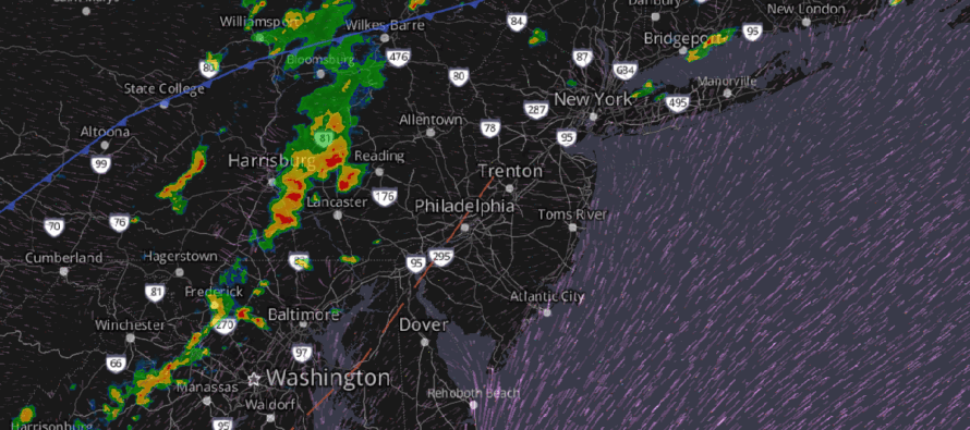
In English: I expect everyone to at least get in on a brief period of rain with rumbles likely this evening…seems like a safe widespread and reasonable expectation. I expect there to be localized instances (not everyone) of frequent lightning, straight line winds and flash flooding. SNJ has the best dynamics for severe storms but all are on the hook. is typically not a tornado setup for NJ but you can take it off the table completely…a small non-zero chance with straight line winds more probable. This should all come through from W to E as an organized storm front at an axis similar to I-95. Therefore, NWNJ sees it first (by 5-6pm), the NJTP axis (from SWNJ to NENJ) sees it by 6-7pm, and then lastly, the SENJ coast sees it by 7-9pm. Nine times out of ten, they weaken into exhausting gust fronts for the coast. But there’s always that one out of ten time that storms sustain strength to the coast. Since this stormfront is rolling in during/immediately after peak temperatures, I would lean a little bit towards the holding KABANG potential closer to the coast. I’ll be posting radar observations. Be safe! JC
Premium Services
KABOOM Club offers ad-free content, inside info forecast discussion, your questions answered, and early storm impact maps and video releases (ahead of the public). At $1.99 per month, it’s an extremely feasible way to show additional support for Weather NJ and you can can turn it on and off for however many months you wish. Think of it as a tip jar with perks. The public eventually sees all info discussed in premium areas. Available onFacebook or Patreon.
My Pocket Meteorologist (MPM), in partnership with EPAWA Weather Consulting, offers professional/commercial interests, whose businesses depend on outdoor weather conditions (snow plowing, landscaping, construction, etc.), with hyper-local text message alerts/forecasts and access to the MPM premium forum—the most comprehensive and technical forecast discussion available for PA and NJ.
Jonathan Carr (JC) is the founder and sole operator of Weather NJ, New Jersey’s largest independent weather reporting agency. Since 2010, Jonathan has provided weather safety discussion and forecasting services for New Jersey and surrounding areas through the web and social media. Originally branded as Severe NJ Weather (before 2014), Weather NJ is proud to bring you accurate and responsible forecast discussion ahead of high-stakes weather scenarios that impact this great garden state of ours. All Weather. All New Jersey.™ Be safe! JC


LOCAL FORECAST | INTERACTIVE RADAR | LATEST NJ WEATHER ALERTS | WEDDING FORECAST| PRIVACY POLICY
© Copyright 2026 Weather NJ LLC. All Rights Reserved.
Some information that can be found on our website is provided by a private weather station and is not an officially recognized station for weather reporting. Though we always strive to achieve accurate reporting for our own use, it is important that you do NOT depend on the data provided here for any purpose.
