

Thursday Still Looking Windy/Stormy
Discussion: No real changes to what is expected Thursday…a windy day and stormy night.
The last of this unnecessary cold air mass will clear out on Wednesday. Just need to hang in there one more cold night. By Wednesday afternoon it should feel much better with the advancing warm front from the SW.
Thursday looks like the warmest day of the remaining week with direct warm sector influence. One of those days where temps could really soar into/through the 70s. Daytime hours look mixed with sun and clouds but S/SW winds should rip pretty good with the windiest locations likely occurring closer to the coast.
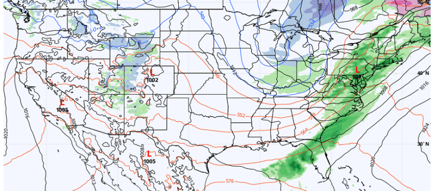
Thursday night looks the most unsettled as a cold front approaches from the W. There should be rain and thunderstorms along/ahead of this front but they still appear modeled with a scattered nature, not a linear (everyone gets a storm) nature. There will be a low center following the front through which could enhance lifting aloft. That could mean rain and storm enhancement and I am still watching this closely.
Friday/Friday night looks breezy and colder in the immediate wake of the cold front but not as cold as this week’s Monday-Tuesday. Saturday and Sunday then looks slightly warmer than Friday…highs ranging mid-50s to lower-60s N to S but lows still down into 30s. Thanks to colder airmass aloft!
April still looks cold for the first third of it. Lots of stubborn trough swinging in the NE US. But eventually we’ll emerge into a sustainable warmer pattern (as we typically do in April). But a cold start to spring for sure.
In English: The BS cold ends tomorrow. Wednesday and Thursday then much milder until rain/wind/storms Thursday night. Thunderstorms could be severe and rainfall could be heavy but I think S/SW winds will have the headline for Thursday. Friday a bit cold again then a milder Saturday and Sunday with dry conditions. That’s how it looks for now. Have a great rest of your Tuesday and please be safe! JC
Premium Services
KABOOM Club is more for the snow lover or weather nerd who needs inside info with early forecast discussion and storm impact maps (ahead of the public). It’s a bit more complex than what the public sees but offers the “In English” with it. It’s also a way to support Weather NJ with a 99-cent per month contribution.
My Pocket Meteorologist offers commercial interests, whose businesses depend on outdoor weather conditions (snow plowing, landscaping, construction, etc.), with hyper-local text message forecasts and access to the My Pocket Meteorologist premium forum. This information is the most complex analysis available as needed by the outdoor commercial sector.
Jonathan Carr (JC) is the founder and sole operator of Weather NJ, New Jersey’s largest independent weather reporting agency. Since 2010, Jonathan has provided weather safety discussion and forecasting services for New Jersey and surrounding areas through the web and social media. Originally branded as Severe NJ Weather (before 2014), Weather NJ is proud to bring you accurate and responsible forecast discussion ahead of high-stakes weather scenarios that impact this great garden state of ours. All Weather. All New Jersey.™ Be safe! JC


LOCAL FORECAST | INTERACTIVE RADAR | LATEST NJ WEATHER ALERTS | WEDDING FORECAST| PRIVACY POLICY
© Copyright 2026 Weather NJ LLC. All Rights Reserved.
Some information that can be found on our website is provided by a private weather station and is not an officially recognized station for weather reporting. Though we always strive to achieve accurate reporting for our own use, it is important that you do NOT depend on the data provided here for any purpose.
