

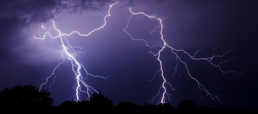
Tomorrow Looks Stormy
Discussion: Outside of a few possible isolated pop-ups (along sea breeze, etc.), we should remain mostly dry today. Temps are maxing in the low-to-mid 80s. Humidity is a little stickier in SENJ than NWNJ but overall manageable. We should also have a nice and clear night.
Tomorrow, a warm front will first move through NJ from S/SW to N/NE, between about sunrise and noon. As this boundary advances, areas along and behind it will see increased humidity, cloud coverage, periods of rainfall, and even some embedded thunderstorms (likely the cloudy day rolling thunder kind). This warm front passage will constitute the first phase of tomorrow’s expectations.
At the upper levels we have a ridge flexing in the W US and trough digging just off the Mid-Atlantic and NorthEast US. This is aligning the geopotential height fields into a highway for thunderstorms to travel down from the NW or W/NW:
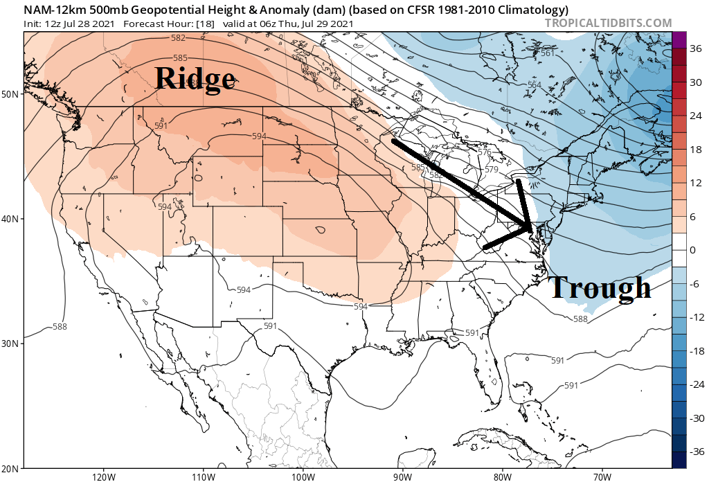
Therefore, we have some interesting dynamics at play between the Great Lakes region and New Jersey. Immediately following the warm front, we should see some of this action between tomorrow afternoon (Thursday) and overnight hours (into Friday morning). Additionally, the low that the warm front will be attached to should track across EPA and NNJ overnight. This will provide additional lifting for thunderstorm generation.
So I think Thursday is going to first be a cloudy/stormy day followed by on-and-off thunderstorms, possibly severe, for Thursday afternoon through early Friday morning. The best dynamics exists to our W along the Mason Dixon line between PA and MD. Therefore, I think SWNJ (including Philly and maybe up to Trenton) have the best chance to experience severe thunderstorms from either a slightly unorganized mess of scattered thunderstorms or possibly a more organized Mesoscale Convective System (MCS). The rest of NJ (NNJ, ECNJ, SENJ) will likely just see traditional non-severe thunderstorms throughout the day tomorrow. There will be a lot of cloud debris and convergence in NJ tomorrow before the possible MCS which could inhibit stronger storms from forming. The air will be too stable IMO for NENJ to get in on severe action. CNJ could go either way. However these kind of systems can quickly defy instability parameters used as guidance especially if a strong enough MCS can form (like a Derecho). I’ll be tracking this close tomorrow.
The good news is that a cold front (also attached to the low) will push through Friday morning and bring us an amazing refreshing weekend. Friday will feel better but might still be a day of cooler/drier transition. For Saturday and Sunday, we’re talking low humidity with temps ranging from 70-80 during the day and 50-60 at night.
In English: Tomorrow (Thursday) looks like a cloudy, rainy, stormy, muggy day for most daytime hours (sunrise to afternoon) due to a warm front. Then more downpours and thunderstorms are likely for the rest of the evening and into Friday morning due to enhanced dynamics coming from our W/NW. Severe criteria thunderstorms are possible (for wind and hail) and flash flooding is possible from heavy slow-moving downpours. SWNJ is most favored for severe storm action (during afternoon/early evening hours) but all of NJ is on the hook for at least non-severe storms. Best to plan for severe and play it safe. I’ll be tracking closely tomorrow. Once this all clears out (by Friday morning) we’re in for a solid stretch of dry and comfortable summer weather conditions through at least the rest of the weekend, possibly until mid next week. Have a great night and please be safe! JC
Download the free Weather NJ mobile app on Apple or Android. It’s the easiest way to never miss Weather NJ content. Our premium services go even further above and beyond at the hyper-local level.
Jonathan Carr (JC) is the founder and sole operator of Weather NJ, New Jersey’s largest independent weather reporting agency. Since 2010, Jonathan has provided weather safety discussion and forecasting services for New Jersey and surrounding areas through the web and social media. Originally branded as Severe NJ Weather (before 2014), Weather NJ is proud to bring you accurate and responsible forecast discussion ahead of high-stakes weather scenarios that impact this great garden state of ours. All Weather. All New Jersey.™ Be safe! JC


LOCAL FORECAST | INTERACTIVE RADAR | LATEST NJ WEATHER ALERTS | WEDDING FORECAST| PRIVACY POLICY
© Copyright 2025 Weather NJ LLC. All Rights Reserved.
Some information that can be found on our website is provided by a private weather station and is not an officially recognized station for weather reporting. Though we always strive to achieve accurate reporting for our own use, it is important that you do NOT depend on the data provided here for any purpose.
