

Unsettled and Cloudy at Times
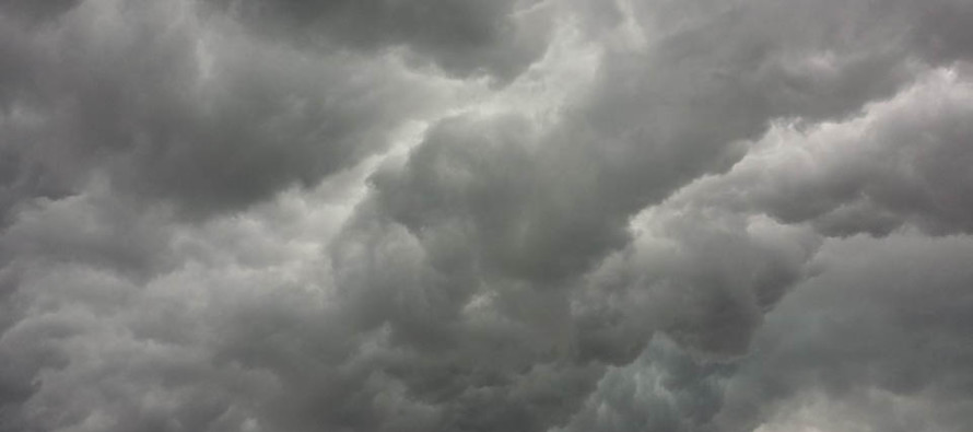
Discussion: The drier fallish-feeling air mass managed to stick around for Monday while temperatures maxed near-80 for many locations. The wind was what it was this past weekend but the highest sun angle of the year put up a nice fight and still allowed a pleasant feel. We were caught in some jet the last few days…sandwiched between high pressure over the lakes and low pressure over Maine/SE Canada. As expected, we were under the back-side of a trough which produced stiff parallel NW flow at most tropospheric layers, especially surface winds. The trough will now move off and heights will rise. It appears that there will be no solid ridging establishing over the E US this week despite the positive geopotential height anomalies. This will result in the prevention of any heat waves (3 days+ of 90+) from happening but will feel warmer and summerier than this past weekend. Temperatures should increase a bit but you’ll likely notice the increase in humidity more so. It’s a very unsettled and chaotic look this week. Some sunny periods but clouds and showers likely with random thunderstorms possible pretty much any day. Run-of-mill summer conditions IMO but a little cloudier looking than I would like to see.
Ocean temperatures are almost to 70 degrees. That means that onshore flow no longer ruins your beach picnic—sending people running to their cars for hoodies and cover-ups. We’re just about to the point where onshore breeze/flow provides a pleasant feel instead. The biggest influence on ocean temperatures for us are SE winds. This allows the warmer surface of the gulf stream to blow into the coasts. NW winds do the opposite and blow the warmer surface waters away from the coast—allowing colder water to replace it from underneath (upwelling). NW vs SE flow can therefore fluctuate ocean temps along the beach by 5 degrees sometimes more. So just keep that in mind.
Monday (June 20) night overnight lows should drop into the 50s for most (60s for immediate coastal areas). Enjoy the last of the drier air mass because Tuesday starts a more summery look and feel…and right on time.
Tuesday (June 21) high temperatures should reach the upper-70s/lower-80s with a humid feel. Skies should be mainly cloudy with scattered showers and isolated thunderstorms possible. Winds should be light out of the S/SW. Overnight lows should range from 60-70 from elevations to coasts.
Wednesday (June 22) high temperatures should reach the mid-to-upper 70s for most areas. Skies should be mixed with sun and clouds with a few showers and thunderstorms around. Winds should be light out of the SE away from the ocean…breezier along the immediate coastal areas. Overnight lows should fall to the 60-65 range for most areas.
Thursday (June 23) high temperatures should reach near-80 for most areas. Skies should be partly-to-mostly cloudy with more showers and thunderstorms around. Winds should be light out of the S/SE. Overnight lows should again hover in the 60-65 range for most areas.
Friday (June 24) high temperatures should reach near-80 for most areas. Skies should be partly-to-mostly cloudy with isolated showers and thunderstorms around. Winds should be light out of the E/SE. Overnight lows should again hover in the 60-65 range for most areas.
An early look at the weekend indicates warmer temperatures with interior CNJ/SNJ possibly pushing into the 90s. The more humid and unsettled nature looks to stick around. Not a washout but nuisance isolated/scattered showers and thunderstorms. Let’s see how we look in a few days. Have a great week and please be safe! JC
Premium Services
KABOOM Club offers inside info forecast discussion, your questions answered, and early storm impact maps (ahead of the public). At a buck per month, it’s an extremely feasible way to show support.
My Pocket Meteorologist (MPM), in partnership with EPAWA Weather Consulting, offers professional/commercial interests, whose businesses depend on outdoor weather conditions (snow plowing, landscaping, construction, etc.), with hyper-local text message alerts/forecasts and access to the MPM premium forum—the most comprehensive and technical forecast discussion available for PA and NJ.
Jonathan Carr (JC) is the founder and sole operator of Weather NJ, New Jersey’s largest independent weather reporting agency. Since 2010, Jonathan has provided weather safety discussion and forecasting services for New Jersey and surrounding areas through the web and social media. Originally branded as Severe NJ Weather (before 2014), Weather NJ is proud to bring you accurate and responsible forecast discussion ahead of high-stakes weather scenarios that impact this great garden state of ours. All Weather. All New Jersey.™ Be safe! JC


LOCAL FORECAST | INTERACTIVE RADAR | LATEST NJ WEATHER ALERTS | WEDDING FORECAST| PRIVACY POLICY
© Copyright 2026 Weather NJ LLC. All Rights Reserved.
Some information that can be found on our website is provided by a private weather station and is not an officially recognized station for weather reporting. Though we always strive to achieve accurate reporting for our own use, it is important that you do NOT depend on the data provided here for any purpose.
