

Unsettled Conditions Expected (Dec 22-24)
Discussion: An area of ridging should dominate the weather pattern through Sunday. This means milder temperatures overall with an especially gloomy Saturday. While Saturday does not look like an all-day washout, it should feature periods of fog, drizzle and on/off rainfall. Sunday looks like a clearing day of transition. Monday and forward looks to feature much colder temperatures. A trough should swing through in response to strong poleward –EPO ridge displacement. This should set the stage for a cold week leading up to a possible winter storm in the Dec 29-30 period. I’m seeing some strong storm signals for this period from this range and therefore I intend to follow closely.
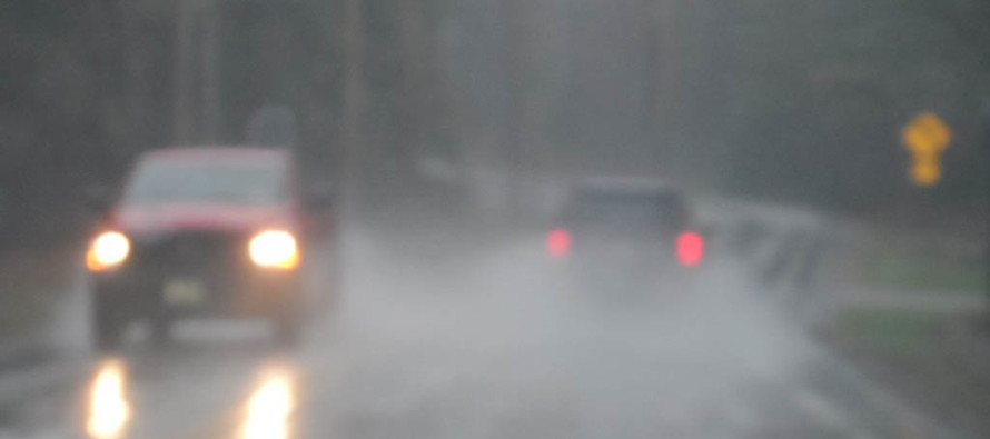
Friday (Dec 22) high temperatures should reach into the 50s for many. Only NNJ should hang in the 40s after some light AM precipitation moves out. Skies should be mostly cloudy. Winds should be light out of the S/SE. Overnight lows should fall into the 40s for most with NNJ/NWNJ likely dipping into the 30s.
Saturday (Dec 23) high temperatures should range from upper-40s to near-60 from NNJ to SNJ. Skies should be mostly cloudy with periods of fog and rainfall likely. Winds should be light out of the S/SW. Overnight lows should fall into the 30s for most. NNJ could dip into the 20s.
Sunday (Dec 24) high temperatures should range from lower-40s to upper-40s NNJ to SNJ. Skies should be partly sunny. Winds should be light out of the N/NE. Overnight lows should range from upper-20s to lower-30s NNJ to SNJ.
An early look at next week indicates possible snowfall on Christmas Day. I expect this to be a light and conversational event rather than disruptive. The lower levels of the atmosphere will likely still be too warm for stickage. It might just be cool to see a few snowflakes. We’re then looking at a very cold rest of next week leading up to the winter storm signal period (Dec 28-30). I’ll speak more to this on Sunday when I post the Monday-Friday Outlook. I’ll also update the Christmas Day snow expectations then if anything has changed. Have a great weekend and please be safe! JC
For comprehensive and interactive hyper-local analysis that goes way above and beyond the detail of this public forecast, check out our premium services.
Jonathan Carr (JC) is the founder and sole operator of Weather NJ, New Jersey’s largest independent weather reporting agency. Since 2010, Jonathan has provided weather safety discussion and forecasting services for New Jersey and surrounding areas through the web and social media. Originally branded as Severe NJ Weather (before 2014), Weather NJ is proud to bring you accurate and responsible forecast discussion ahead of high-stakes weather scenarios that impact this great garden state of ours. All Weather. All New Jersey.™ Be safe! JC


LOCAL FORECAST | INTERACTIVE RADAR | LATEST NJ WEATHER ALERTS | WEDDING FORECAST| PRIVACY POLICY
© Copyright 2025 Weather NJ LLC. All Rights Reserved.
Some information that can be found on our website is provided by a private weather station and is not an officially recognized station for weather reporting. Though we always strive to achieve accurate reporting for our own use, it is important that you do NOT depend on the data provided here for any purpose.

)