

Wednesday Thunderstorm Update
Discussion: Just wanted to focus in on some more details for this week. Today (Monday) and tomorrow (Tuesday) still look to feature the immediate warm sector leading up to a cold front. That means today and tomorrow will remain warm and muggy (especially along the I-95/NJTP corridor) with S/SW winds increasing as the front closer approaches.
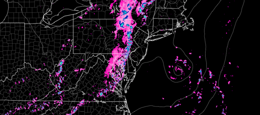
What’s changed is the timing of the cold front for Wednesday. It now looks to happen earlier in the day. Any rain or t-storms along/just ahead of the cold front should happen during AM hours and possibly even before rush hour. This frontal energy should be inhibited by the morning lack of peak diurnal heating and should quickly cast its energy out to sea towards a weak passing offshore disturbance. The actual cold front (felt mostly via dropping dew points) would then likely clear the Jersey coast sometime between late-morning and afternoon allowing W/NW flow for the remainder of Wednesday. You’ll know it’s through when it feels magical outside.
You might see a solid thunderstorm line approach WNJ by early Wednesday morning (higher PA impacts) but again, this is expected to fizzle out by the time it crosses over into ENJ. I doubt anything but scattered showers and a few rumbles would make it to ENJ despite severe conditions possible for EPA and maybe the WNJ border area.
The rest of Labor Day weekend still looks like yesterday’s early outlook. Very low humidity with pleasant feel Thursday through Saturday (now Wednesday PM through Saturday). A bit warmer with humidity returning Sunday and Monday (iso storm chances). The full and detailed Labor Day Weekend outlook will be out tomorrow. I just wanted to let you know that the good stuff should arrive a littler earlier on Wednesday rather than Wednesday night/Thursday morning.
The tropics are continuing to focus on something in the Sept 3-10 period. It’s starting to look like a hurricane could be off the east coast in the ~Sept 6 (give or take) period. As of right now, model guidance keeps it away from land but would mean increased surf/rip tides. It would also help pull down much drier and cooler air for the week after LDW. Still tracking this though so a lot of room for changes to specific impact. The general tropical signal however remains strong.
In English: Today (Monday) and tomorrow (Tuesday) will remain hot and muggy. Wednesday still looks like a day of transition but now earlier in the morning rather than later in the evening. Because of that, any thunderstorms riding Wednesday’s cold front now look weaker…even though they may bang up parts of PA. This would produce lower humidity (relief) for Wednesday PM through at least Saturday with clear skies. Sunday and Monday would then return to higher humidity with iso shower/t-storm chances especially Sunday night-forward into Monday. The full detailed LDW outlook will be out tomorrow.
Premium Services
KABOOM Club offers inside info forecast discussion, your questions answered, and early storm impact maps (ahead of the public). At a buck per month, it’s an extremely feasible way to show support.
My Pocket Meteorologist (MPM), in partnership with EPAWA Weather Consulting, offers professional/commercial interests, whose businesses depend on outdoor weather conditions (snow plowing, landscaping, construction, etc.), with hyper-local text message alerts/forecasts and access to the MPM premium forum—the most comprehensive and technical forecast discussion available for PA and NJ.
Jonathan Carr (JC) is the founder and sole operator of Weather NJ, New Jersey’s largest independent weather reporting agency. Since 2010, Jonathan has provided weather safety discussion and forecasting services for New Jersey and surrounding areas through the web and social media. Originally branded as Severe NJ Weather (before 2014), Weather NJ is proud to bring you accurate and responsible forecast discussion ahead of high-stakes weather scenarios that impact this great garden state of ours. All Weather. All New Jersey.™ Be safe! JC


LOCAL FORECAST | INTERACTIVE RADAR | LATEST NJ WEATHER ALERTS | WEDDING FORECAST| PRIVACY POLICY
© Copyright 2026 Weather NJ LLC. All Rights Reserved.
Some information that can be found on our website is provided by a private weather station and is not an officially recognized station for weather reporting. Though we always strive to achieve accurate reporting for our own use, it is important that you do NOT depend on the data provided here for any purpose.
