

Weekend Rain and Wind Storm Approaching
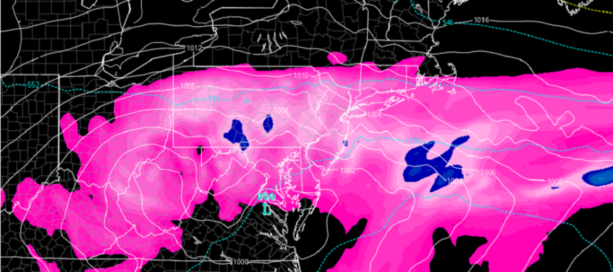
Discussion: The cause for this weekend’s rain and wind storm is an upper low drifting across the E US between now and early next week. During this time, a few areas of concentrated low pressure will organize at the surface and deliver the lifting and pressure gradients (high to N) for heavy rain and wind.
The majority of rainfall should fall this evening and all of Saturday (statewide). On Sunday the system will be clearing out (rain-wise), thanks to NE trough interaction and N high pressure squash, but might not clear SNJ until later Sunday (late-morning to afternoon). This is still yet TBD but NNJ looks drier on Sunday as of now. I’ll update through the weekend accordingly. For now, here is our rain impact map
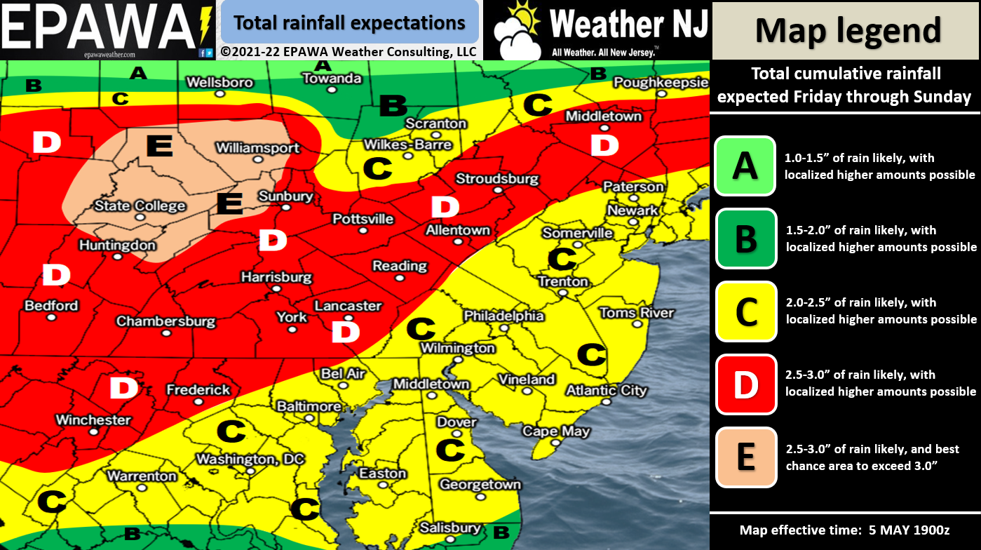
Click here for full resolution rain map.
Winds should get going tonight and crank for most of Saturday. We’re looking at 40-50mph wind gusts along the ECNJ/SENJ coasts and slightly lesser values away from the ocean and in NNJ. Wind direction should start out of the E/SE and end out of the NE.
Coastal flooding is very likely. Water levels should be up from tonight through Tuesday with the prolonged onshore flow. This should be enough to cause minor-to-moderate coastal flooding for ECNJ/SENJ/SNJ with the highest tide anticipated Saturday night/Sunday morning when the lower level onshore jet rages the highest. With the moon being between new and full, we have lower astronomical tides which should ultimately prevent the major coastal flooding category from happening. IMO, flash flooding statewide from heavy rainfall, is just if not more of a flooding hazard than for coastal regions.
The rest of Sunday through Tuesday should remain cool and windy as the upper low finally departs. I’m still seeing a ridge building by mid next week that should bring warm (70F+) temps to all of NJ and that looks to start a pattern of sustainable warmer spring temperatures. Finally!
In English: Expect Book of Genesis-like rainfall tonight and tomorrow with anything from 1.5 to 4 inches of rain possible. Rain should end for NNJ/CNJ earlier Sunday morning and possibly later Sunday afternoon for SNJ. It might be lae-afternoon Sunday before the rain tapers for extreme SENJ with nor’easter like wind conditions. Expect small human beings to be blown around if not secured, especially on Saturday when winds can reach the 40-50mph zone, especially for coastal regions. Expect water in the streets for coastal locations that normally see water in the streets tonight through at least Monday, especially Saturday night into Sunday (highest expected water levels). Even if the rain stops for most on Sunday, the cooler temps and stronger winds should carry into early next week. Basically, expect crappy weather conditions for Mother’s Day Weekend in NJ. Here’s to hoping the rain clears earlier than later on Sunday for all. Be safe! JC
Premium Services
KABOOM Club is more for the snow lover or weather nerd who needs inside info with early forecast discussion and storm impact maps (ahead of the public). It’s a bit more complex than what the public sees but offers the “In English” with it. It’s also a way to support Weather NJ with a 99-cent per month contribution.
My Pocket Meteorologist offers commercial interests, whose businesses depend on outdoor weather conditions (snow plowing, landscaping, construction, etc.), with hyper-local text message forecasts and access to the My Pocket Meteorologist premium forum. This information is the most complex analysis available as needed by the outdoor commercial sector.
Jonathan Carr (JC) is the founder and sole operator of Weather NJ, New Jersey’s largest independent weather reporting agency. Since 2010, Jonathan has provided weather safety discussion and forecasting services for New Jersey and surrounding areas through the web and social media. Originally branded as Severe NJ Weather (before 2014), Weather NJ is proud to bring you accurate and responsible forecast discussion ahead of high-stakes weather scenarios that impact this great garden state of ours. All Weather. All New Jersey.™ Be safe! JC


LOCAL FORECAST | INTERACTIVE RADAR | LATEST NJ WEATHER ALERTS | WEDDING FORECAST| PRIVACY POLICY
© Copyright 2025 Weather NJ LLC. All Rights Reserved.
Some information that can be found on our website is provided by a private weather station and is not an officially recognized station for weather reporting. Though we always strive to achieve accurate reporting for our own use, it is important that you do NOT depend on the data provided here for any purpose.
