

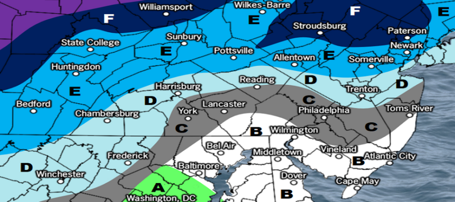
Weekend Snow Map
Discussion: Our first system (Friday-Saturday) is now within line of sight to begin forecasting. Still some time to monitor the Monday-Tuesday system. With that said, let’s set some expectations. You are about to see two maps. The first map represents the general idea of what to expect regarding precipitation types and where they fall on the timeline of the event. The second map is the traditional snowfall map. The snowfall map is geared towards what we believe will fall out of the sky, not how much will stick and not the difference between stickage on natural vs paved surfaces.
Stickage ratios will vary from N to S. Areas N of I-78 have the best chance for stickage. Areas S/SE of I-95 have the best chance to see white rain (snow that falls but melts immediately on contact). Areas between I-78 and I-95 could go either way and will depend on snowfall rate intensity as well as time of snowfall (still during dark hours or during sunrise). Since we’re entering mid-March, higher sun angle means quicker melting ability and quicker rise in temperatures above freezing.
The mid-to-upper levels will be below freezing for most of this event in all areas. It’s only the baroclinic boundary near the surface that will have most NJ folks in the 33-37 range. Heavy snowfall will drop the surface to 32 and allow stickage. Lighter snowfall will likely hit the ground as white rain. So we’re dealing with a lot of variables here that could produce either a surprise (with higher snow rates overnight – lower chance) or a lower snow accumulation outcome (more likely).
With that said, the storm track and transfer principals, that we’ve been discussing in prior articles, are still in play. Initial precip, associated with the primary low, arrives Friday afternoon/evening in a warmer surface environment (day still cooling from peak temps). This should create a snow/rain line across NJ somewhere near or just N of I-78. The low then transfers and the secondary low pulls the snow/rain line southward behind it. This will initially convert areas between 78 and 95 from rain to snow while it is still dark out (late Friday night-early Saturday morning). For this reason, CNJ has the second best chance of snow sticking after the changeover. Then as the sun begins to rise later in the morning, the final piece of precipitation will fall on CNJ/SNJ as the storm pulls away in an inverted trough-like setup. Again, areas S/SE of 95 have the best chance for white rain. Precip should end and depart CNJ/SNJ tomorrow by noonish. Here are the two maps that describe what to expect Friday afternoon through Saturday morning.
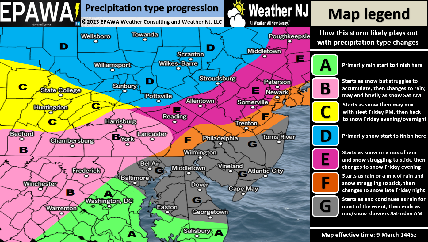
Click here for full resolution map!
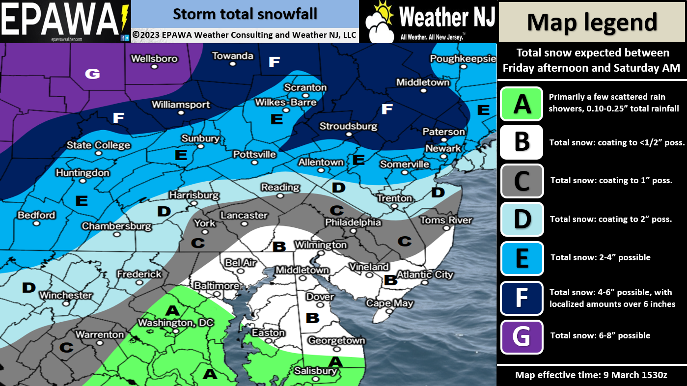
Click here for full resolution snow map!
In English: It’s going to snow but not all snow will stick due to late-season climatology and higher sun angle. The general idea is that after a warmer Friday daytime (temps well into 40s), snow/rain will move into NJ Friday evening as temps drop. Areas that start as snow will remain snow (NNJ areas). Rain will change to snow from N to S (into CNJ and ultimately SNJ) between Friday night and Saturday morning. The above maps give a general idea of what to expect but again, please remember that areas N of I-78 have the best chance of stickage. This will not likely be a plowable event S/SE of I-95 and possibly S of I-78. And also remember that snow will stick more easily to natural surface like grass and trees rather than warmer paved surfaces. Tomorrow we will try to better break apart snowfall vs snow accumulations. For now, this is our best forecast for Friday PM-Saturday AM. Will address Monday-Tuesday separately starting tomorrow. Have a great rest of your Wednesday and please be safe! JC
Premium Services
KABOOM Club offers inside info forecast discussion, your questions answered, and early storm impact maps (ahead of the public). At 99 cents per month, it’s an extremely feasible way to show support.
My Pocket Meteorologist (MPM), in partnership with EPAWA Weather Consulting, offers professional/commercial interests, whose businesses depend on outdoor weather conditions (snow plowing, landscaping, construction, etc.), with hyper-local text message alerts/forecasts and access to the MPM premium forum—the most comprehensive and technical forecast discussion available for PA and NJ.
Jonathan Carr (JC) is the founder and sole operator of Weather NJ, New Jersey’s largest independent weather reporting agency. Since 2010, Jonathan has provided weather safety discussion and forecasting services for New Jersey and surrounding areas through the web and social media. Originally branded as Severe NJ Weather (before 2014), Weather NJ is proud to bring you accurate and responsible forecast discussion ahead of high-stakes weather scenarios that impact this great garden state of ours. All Weather. All New Jersey.™ Be safe! JC


LOCAL FORECAST | INTERACTIVE RADAR | LATEST NJ WEATHER ALERTS | WEDDING FORECAST| PRIVACY POLICY
© Copyright 2026 Weather NJ LLC. All Rights Reserved.
Some information that can be found on our website is provided by a private weather station and is not an officially recognized station for weather reporting. Though we always strive to achieve accurate reporting for our own use, it is important that you do NOT depend on the data provided here for any purpose.
