

Wintry Conditions Expected (Dec 8-10)
Discussion: A low pressure system will track just offshore near the benchmark with about a 990-995mb intensity. This should be enough to throw wintry precipitation off the ocean all the way into PA with NJ seeing the jackpot of accumulations. Our snow map from last night still holds but we’ll have a final call snow map out at 7PM this evening reflecting the latest guidance trends and live observations that we see today. After the system moves out Saturday night, conditions should remain colder through Sunday and to start next week. A clipper snow system is possible Tuesday into Wednesday followed by the coldest day we’ve seen yet on Wednesday. The culprit for this will be true Arctic air moving in behind the clipper low…a cold front within a cold air mass to begin with.
Friday (Dec 8) high temperatures should reach the upper-30s/lower-40s statewide. Skies should begin partly sunny and increase with cloud coverage. A mix of rain and/or snow flurries are possible during PM hours and especially heading through overnight hours as temperatures drop. Winds should be light out of the W/NW. Overnight lows should fall into the 20s for most with SENJ hanging near-30.
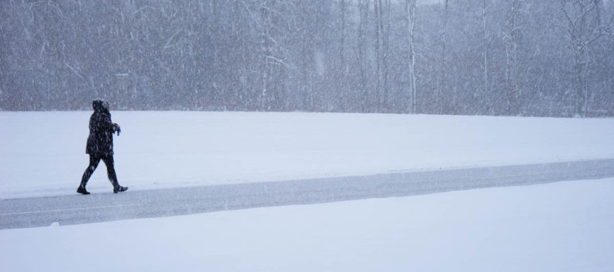
Saturday (Dec 9) high temperatures should reach the low-to-mid 30s statewide. Skies should be mostly cloudy with periods of moderate snowfall likely. A safe general bet is 3-6 inches for SNJ and 2-4 inches for NNJ. Extreme NWNJ might see a bit less and extreme SENJ could deal with rain mixing in. There’s a wildcard chance of some SNJ locations exceeding 6 inches, especially along and just SE of I-95/NJTP but at least 3 inches for that area is a reasonable expectation. Winds should be light out of the N for areas away from the ocean. Immediate coastal areas should see slightly higher winds out of the N/NE. Overnight lows should fall into the 20s for most with immediate coastal areas again hanging near-30…as snow shuts off from W to E and NW winds pick up in strength. The final call snow map for tomorrow will be released at 7PM this evening.
Sunday (Dec 10) high temperatures should struggle to escape the 30s statewide. Skies should be partly sunny with a few remnant snow showers around (little to no accumulation from such). Winds should be breezy-to-gusty out of the W so bundle up for those wind chills! Overnight lows should fall into the 20s for most with immediate coastal areas again hanging near-30.
An early look at next week indicates colder conditions overall. I’m seeing highs struggling to escape the 30s statewide with lows down into the teens and 20s. Wednesday looks like the coldest day of the week. I’m also monitoring another potential snow event for the Tuesday-Wednesday period but as of now it doesn’t look overly disruptive. Looks like a clipper. Let’s revisit this in a few days. Have a great weekend and please be safe.
For comprehensive hyper-local analysis that goes way above and beyond the detail of this public forecast, check out our premium services. Today we’re discussing in real-time/sending alerts for all of the latest short-range guidance trends that will drive our public 7pm final call snow map for tomorrow.
Jonathan Carr (JC) is the founder and sole operator of Weather NJ, New Jersey’s largest independent weather reporting agency. Since 2010, Jonathan has provided weather safety discussion and forecasting services for New Jersey and surrounding areas through the web and social media. Originally branded as Severe NJ Weather (before 2014), Weather NJ is proud to bring you accurate and responsible forecast discussion ahead of high-stakes weather scenarios that impact this great garden state of ours. All Weather. All New Jersey.™ Be safe! JC


LOCAL FORECAST | INTERACTIVE RADAR | LATEST NJ WEATHER ALERTS | WEDDING FORECAST| PRIVACY POLICY
© Copyright 2026 Weather NJ LLC. All Rights Reserved.
Some information that can be found on our website is provided by a private weather station and is not an officially recognized station for weather reporting. Though we always strive to achieve accurate reporting for our own use, it is important that you do NOT depend on the data provided here for any purpose.

)