

Wintry Conditions Possible (Jan 29-Feb 2)
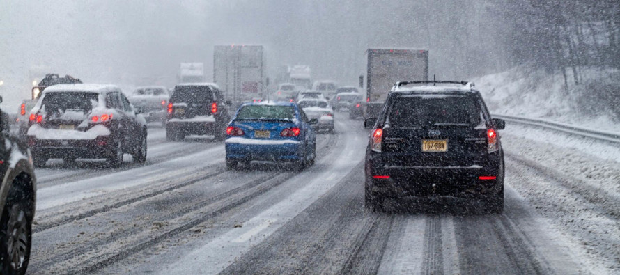
Discussion: A cold front is pressing SE-ward ahead of a transient trough of cold air. Monday’s highs will be reached early in the morning and temps fall from there. The trough should keep us on the colder side Monday PM through about Wednesday. Then we should take one more moderation break Wednesday night through early Friday morning. Friday and into the weekend then looks to start the long-expected colder pattern. As far as precipitation goes, we’re looking at two smaller events to start the week and possibly a more significant event to end the week. Monday afternoon-evening, we have the far-west side of the coastal low’s precipitation shield that could change over from rain to snow. This is really only an I-95 and SE event with little-to-no accumulations expected on roadways. I suppose a light accumulation could stack up on natural surfaces. We’ll have to watch in case this trends a little more aggressive but still shouldn’t be a big deal. Then we have the inverted trough that could bring widespread snow showers to most of NJ. SNJ is currently favored to see more than just flurries, especially SWNJ. A few inches are possible under the heaviest lifting and that could span as far E as the SNJ coast. We’ll then see a break Wednesday into the first part of Thursday. On Thursday we should cloud up ahead of a another approaching frontal boundary. A low is expected to ride this boundary with rain changing over to snow by Friday. As of right now it appears more significant for NWNJ than SENJ but we’ll be watching for changes this week.
Monday (Jan 29) high temperatures should be realized very early in the morning (just after midnight). Temperatures should gradually fall throughout the day, maybe hanging during the afternoon in the 30s. Skies should be mostly cloudy. Rainfall is likely along and SE of I-95/NJTP and could even end as snowfall Monday afternoon-evening. Little-to-no accumulations are expected, especially on roads. Winds should be breezy (gusty near the shore) and rock from E to NW counter clockwise. Much of NJ will fall to near-freezing or just below freezing overnight. Therefore watch out for any wet surfaces that might ice up.
Tuesday (Jan 30) high temperatures should fail to escape the 30s statewide. Skies should be mostly cloudy. Widespread snow showers are expected statewide with possibly a heavier concentration for SNJ and parts of CNJ. Daytime snowfall should struggle to accumulate. Anything still falling through sunset as temperatures crash is fair-game for stickage however. We’ll likely be issuing a map on this tomorrow night. Winds should be light out of the N. Overnight lows should range from single digits to teens NNJ to SNJ.
Wednesday (Jan 31) high temperatures should again fail to escape the 30s however skies should be partly-to-mostly sunny. Winds should be light out of the W. Overnight lows should fall into the 20s statewide.
Thursday (Feb 1) high temperatures should reach the low-to-mid 40s statewide. Skies could start partly-cloudy but should increase in cloud coverage throughout the day. Winds should be light out of the SW, breezier along the coast. Overnight lows should range from mid-20s to mid-30s as precipitation approaches from the W/NW.
Friday (Feb 2) high temperatures should range from upper-20s to upper-30s NNJ to SNJ. Skies should be mostly cloudy. Rain should change to accumulating snow NW of I-95/NJTP. Areas SE of I-95/NJTP could change over to snow but accumulations would be limited by a slower-cooling surface. We’ll issue maps and alerts on this later in the week assuming the possibility has not dropped-off. Winds should be light-to-breezy out of the N/NW. Overnight lows should range from single digits to teens NNJ to SNJ.
An early look at the weekend indicates a cold and dry Saturday through Sunday morning. More precipitation, possibly wintry, could fall later Sunday through Super Bowl time. Let’s revisit this in a few days. Everyone have a great week and please be safe! JC
For comprehensive and interactive hyper-local analysis that goes way above and beyond the detail of this public forecast, check out our premium services which include text notifications and forum access.
Jonathan Carr (JC) is the founder and sole operator of Weather NJ, New Jersey’s largest independent weather reporting agency. Since 2010, Jonathan has provided weather safety discussion and forecasting services for New Jersey and surrounding areas through the web and social media. Originally branded as Severe NJ Weather (before 2014), Weather NJ is proud to bring you accurate and responsible forecast discussion ahead of high-stakes weather scenarios that impact this great garden state of ours. All Weather. All New Jersey.™ Be safe! JC


LOCAL FORECAST | INTERACTIVE RADAR | LATEST NJ WEATHER ALERTS | WEDDING FORECAST| PRIVACY POLICY
© Copyright 2026 Weather NJ LLC. All Rights Reserved.
Some information that can be found on our website is provided by a private weather station and is not an officially recognized station for weather reporting. Though we always strive to achieve accurate reporting for our own use, it is important that you do NOT depend on the data provided here for any purpose.

)