

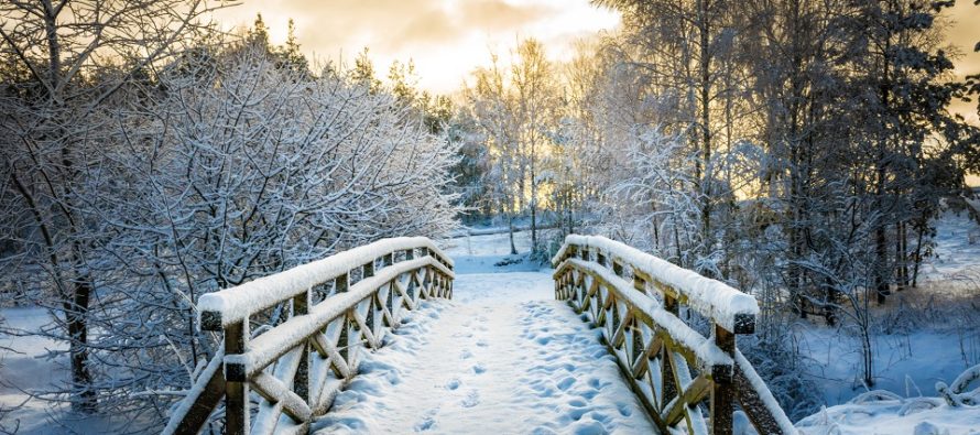
Wintry Pattern Setting In
Discussion: Real quick, tonight looks to remain cold, dry, and breezy/gusty out of the W/NW. Expect temperatures to bottom out in the teens/20s tomorrow (Saturday morning) just before sunrise. A high is approaching. We have the colder front-side flow of it tonight and then calmer conditions tomorrow/tomorrow night underneath it. Tomorrow night (Saturday night) should be the coldest moment of the weekend with sinking air, clear skies, and lighter winds. This is a good recipe for radiational cooling which typically busts temperatures a few degrees lower than computer-generated forecasts. On Sunday we warm up with the departing high’s S return flow. This could generate fog especially over snowpack. We’ll have warmer/wetter air mass advecting into a cold environment at first (Sunday morning) and that’s the best chance for fog. Sunday night we have an approaching cold front with rain likely. For areas still at or below freezing at the surface, this could fall as freezing rain. Currently we only believe this to be an issue for areas NW of NJTP/95, especially NWNJ elevations. We will have the daytime to warm the surface so likely no freezing rain issues along and SE of NJTP/95. Arctic air mass then moves in behind the front for at least Monday-Friday (serious cold). We might moderate some again Thursday-Saturday (with a weak wintry storm signal) before the Arctic cold reloads to likely dominate much of the rest of January. It’s a nice setup for a major snowstorm in the second half of January IMO. There are wintry signals showing Jan 14-15, Jan 19-20, and Jan 22-23. Obviously way too soon for specifics but the N Hemispheric pattern is evolving this way.
Saturday (Jan 8) high temperatures should struggle to rise above the 32F freezing mark. Skies should be mostly sunny. Winds should subside but remain light out of the W/NW. Overnight lows should easily fall into the teens/20s again, possibly single digits in NWNJ elevations and interior SNJ Pine Barrens…we’ll see.
Sunday (Jan 9) high temperatures should range from mid-30s to mid-40s from N to S. Skies should be cloudy with freezing rain possible for colder areas along and NW of NJTP/I-95 (especially NWNJ elevations). Details to come. With warmer/wetter air blowing in from the SW, fog is also a possibility especially in the morning and over snowpack. Overnight lows should then fall to the 20s for most.
An early look at next week indicates drier and much colder conditions during the week leading up to a weak wintry storm signal showing in the Jan 14-15 (Friday-Saturday) period. A colder pattern, more favorable for east coast winter storm development is then expected to begin and last through the end of January. Everyone have a great weekend. Please stay as warm as possible and be safe! JC
Download the free Weather NJ mobile app on Apple or Android. It’s the easiest way to never miss Weather NJ content. Our premium services go even further above and beyond at the hyper-local level.
Jonathan Carr (JC) is the founder and sole operator of Weather NJ, New Jersey’s largest independent weather reporting agency. Since 2010, Jonathan has provided weather safety discussion and forecasting services for New Jersey and surrounding areas through the web and social media. Originally branded as Severe NJ Weather (before 2014), Weather NJ is proud to bring you accurate and responsible forecast discussion ahead of high-stakes weather scenarios that impact this great garden state of ours. All Weather. All New Jersey.™ Be safe! JC


LOCAL FORECAST | INTERACTIVE RADAR | LATEST NJ WEATHER ALERTS | WEDDING FORECAST| PRIVACY POLICY
© Copyright 2026 Weather NJ LLC. All Rights Reserved.
Some information that can be found on our website is provided by a private weather station and is not an officially recognized station for weather reporting. Though we always strive to achieve accurate reporting for our own use, it is important that you do NOT depend on the data provided here for any purpose.
