Worst Flooding Since Sandy. Worse for Some!

The southern New Jersey coast saw the worst flooding since Sandy during this past weekend’s winter storm. Some parts actually saw higher water levels. In fairness, the entire coast from Atlantic City down through Cape May was for the most part spared during Sandy when compared to Atlantic City-northward. But that’s not to minimize this past weekend’s event in ANY way.
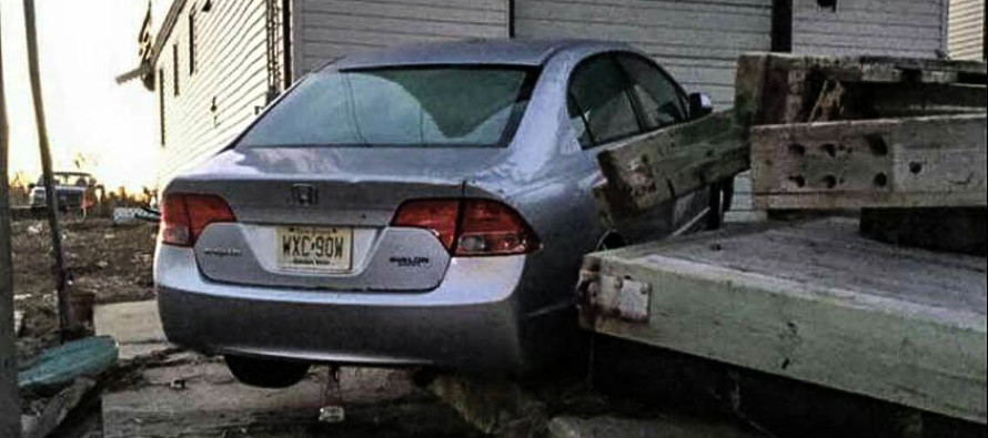
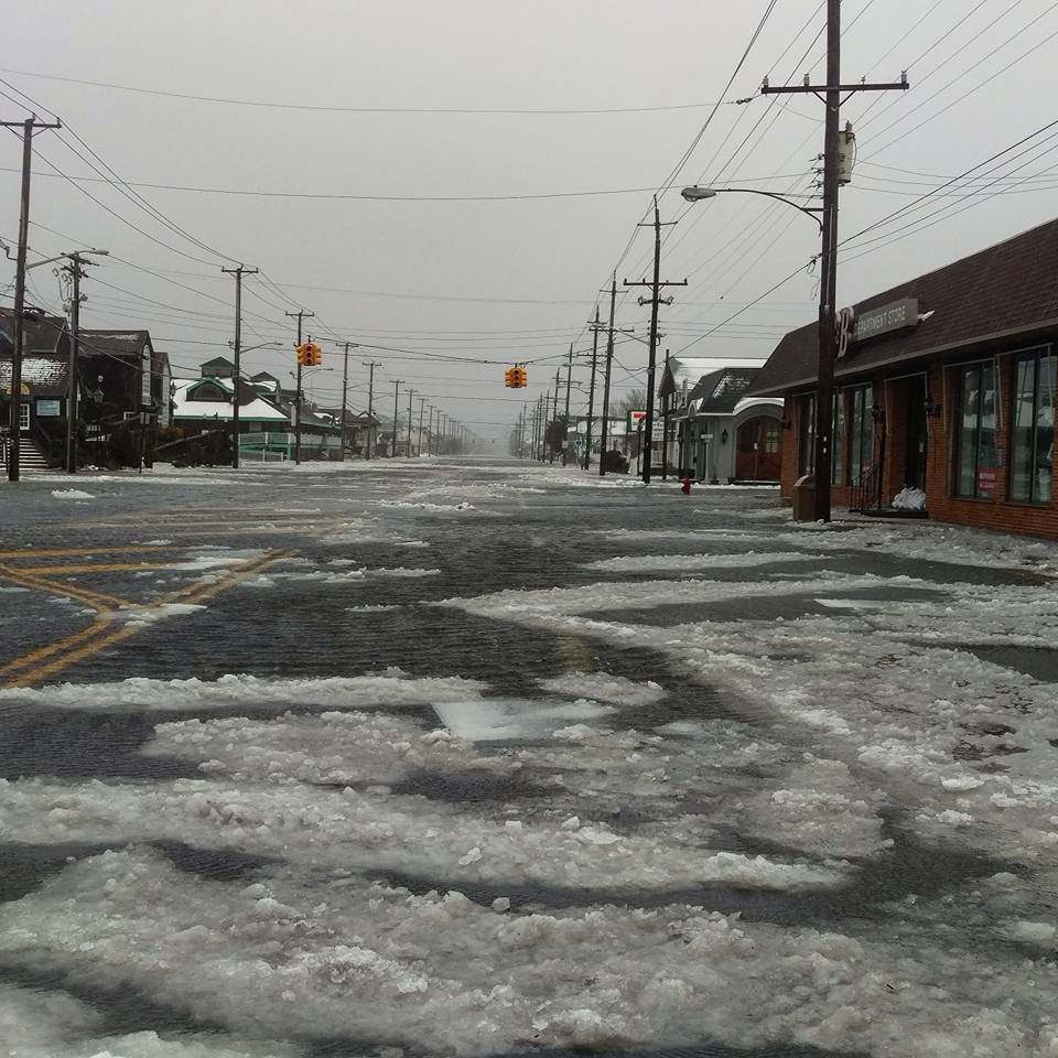
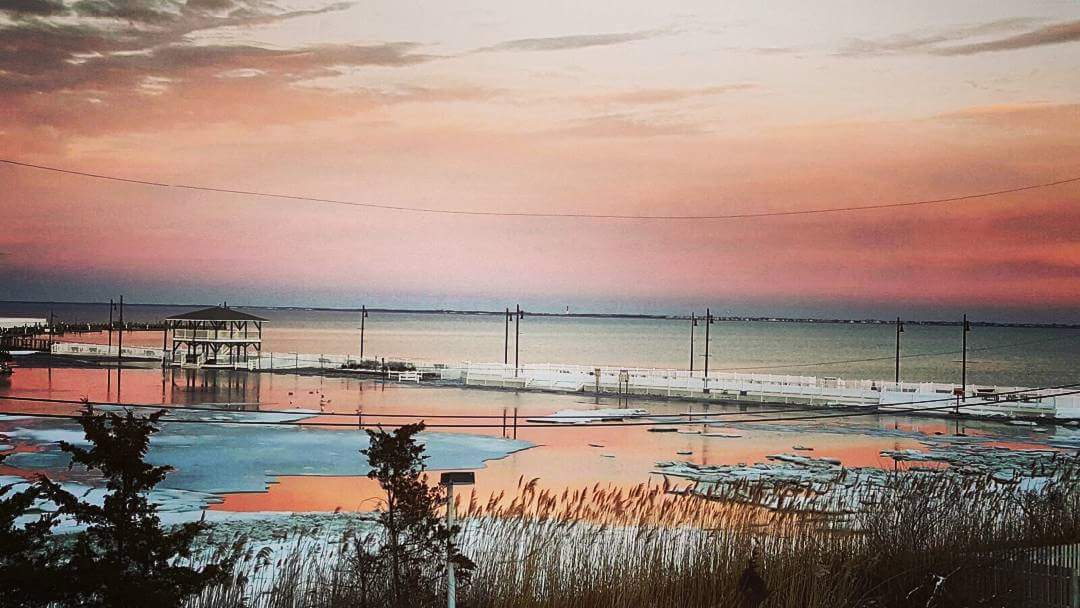
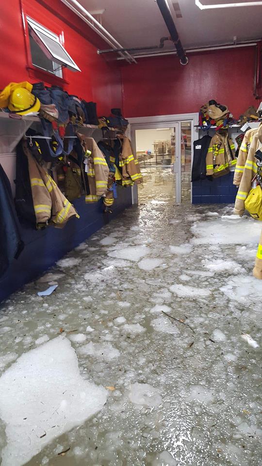
While most of the Mid-Atlantic population away from the coast were wrapped up in snowfall accumulations, coastal residents were placed in a very scary situation with moderate-to-severe flooding. Couple that with the widespread power-outages and downed poles/etc. and it was not a fun position to be in. The following pictures paint the true reality of what happened this past weekend for the southern New Jersey coast: Res ipsa loquitur

Beach Haven, NJ (Ocean County) by John Mosley Borsellino
 Barnegat Municipal Dock in Barnegat, NJ (Ocean County) by Sean D’Antoni

Beach Haven Fire Company in Beach Haven, NJ (Ocean County) by Jay Zimmerman
On Thursday morning, I made this facebook post for a reason:
*** FOR WIDEST DISSEMINATION POSSIBLE ***
This message is directed at all authorities, EMS and offices of emergency management relative to the potential coastal flooding setting up Saturday into Sunday.
While many are focusing on snowfall totals, the coastal flooding risk is moderate to high. Near-full moon + expected wind field related storm surge will impact all coastal areas from the Delaware Bay up to the Long Island Sound. This includes the entire Jersey Shore, NYC and all waters surrounding Long Island.
Southern portions of the Jersey Shore should see the highest levels of flooding (Long Beach Island down through Cape May). For these areas, the latest marine guidance (ESTOFS + MDL) indicates a storm surge of 3-4 feet with total water guidance levels 7-8 feet above mean surface levels. All other coastal areas are still subject to higher levels but not as much as LBI to Cape May. The only exception to that are the back bays near NYC where a storm surge of 4-5 feet is possible. This especially concerns the 3 high tides that exist between Saturday morning and Sunday afternoon.
To non-authorities, take a deep breath and try to relax. We’ve seen this before and as long as you use your head, you will be okay. Things can be replaced. People cannot. Please listen to your authorities should they issue evacuations. They are trained professionals in assuring your safety. Evacuations have not been issued yet but they are possible along with the issuance of a state of emergency.
I will have an update for the weekend snowfall out by 5PM today. Currently I see no major tweeks other than maybe raising the totals in SNJ a bit. Please be safe! JC
I started Weather NJ (originally Severe NJ Weather) to bring safety awareness and critical information aggregation to ALL of New Jersey, not just the more heavily populated areas that surround the I-95 corridor. Often southeastern New Jersey gets left out and downplayed by many. Not here! Stay strong Jersey coast and if there is anything I can do to help disaster recovery, please let me know. Be safe! JC
Top image credit: West Wildwood, NJ by Sherri Linne
Jonathan Carr (JC) is the founder and sole operator of Weather NJ, New Jersey’s largest independent weather reporting agency. Since 2010, Jonathan has provided weather safety discussion and forecasting services for New Jersey and surrounding areas through the web and social media. Originally branded as Severe NJ Weather (before 2014), Weather NJ is proud to bring you accurate and responsible forecast discussion ahead of high-stakes weather scenarios that impact this great garden state of ours. All Weather. All New Jersey.™ Be safe! JC


