

Nov 10: Monitoring Light Snow Possibility
A weak low pressure disturbance wants to flirt with coastal mid-Atlantic regions shortly after the cold front moves through. Exact timing would be Friday morning, starting before sunrise and ending by early afternoon. It’s important to note that lake effect snow could drop a few flurries in the Thursday-Friday period as well (like last Friday). According to model guidance, coastal New Jersey would have a better chance than interior New Jersey. Again, we’re talking about a possible nuisance event here with disruptive accumulations currently off the table.
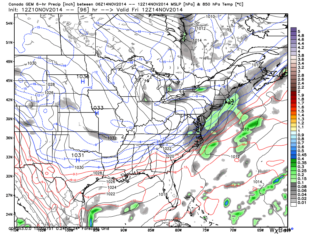
Let’s look at some supporting guidance. First is the Canadian model showing pressure, temperatures and precipitation at 850mb early Friday morning. This shows flurries across New Jersey with a slightly higher concentration right along the shore:
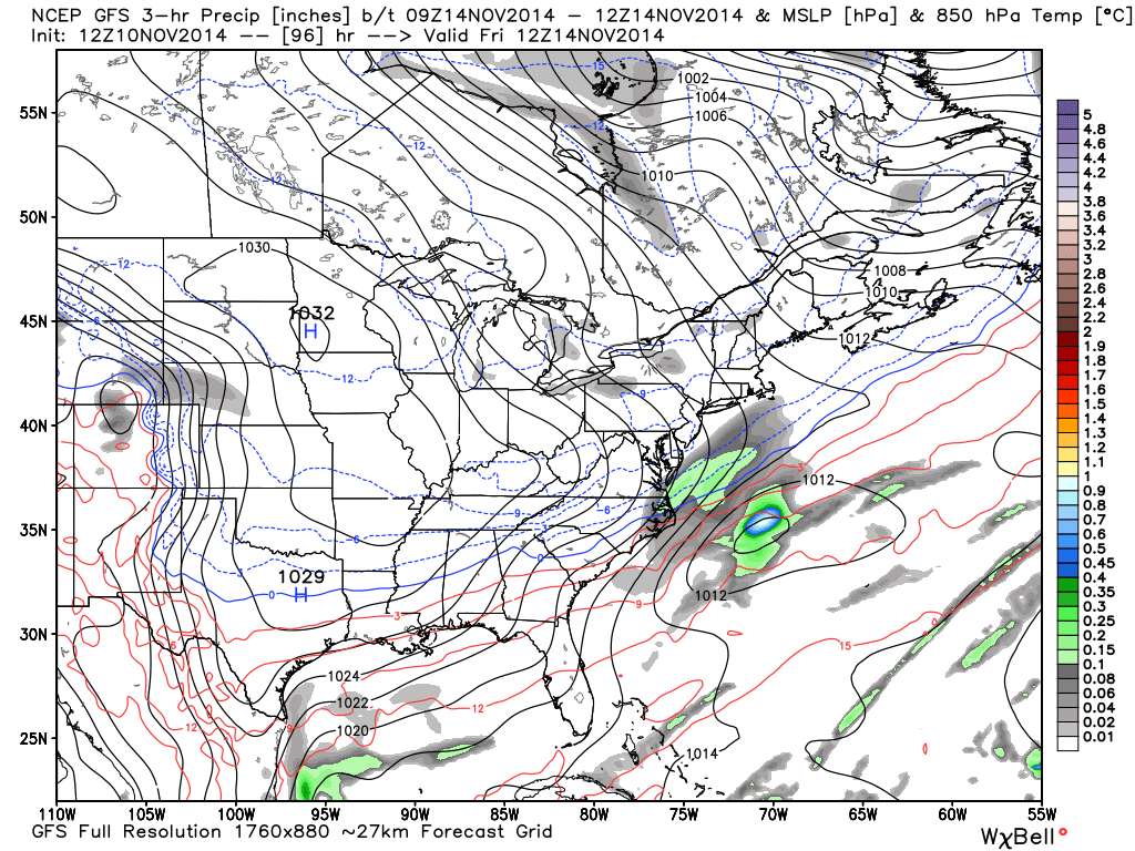
Next up is the GFS showing the same time period and model parameters (850mb pressure + temps + precip). The GFS has the system slightly offshore but close enough to fall in line with guidance:
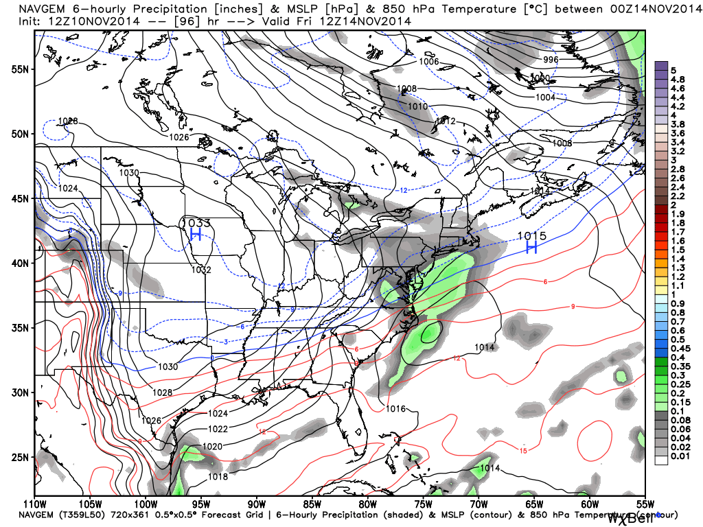
The NAVGEM (Navy model) has the most support for this light event. Same deal…850mb pressure + temps + precip:
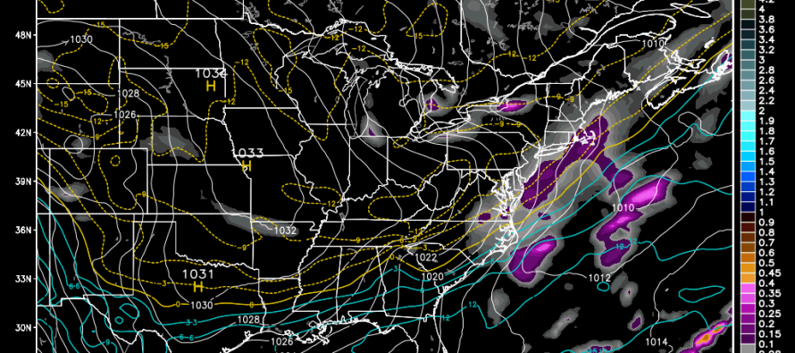
The European model shows a solution more in line with the Canadian with precipitation far enough onshore for light snow to fall across New Jersey. Again, this is not a big deal by any means but for many, it could be the first visible snowfall since last winter. It should all fall between late Thursday night and early Friday afternoon…light snow with trace accumulations at most (on non man-made surfaces). As I said in the Monday-Friday Outlook, I’m much more interested in the Sunday-Tuesday period for snow. Be safe! JC
Jonathan Carr (JC) is the founder and sole operator of Weather NJ, New Jersey’s largest independent weather reporting agency. Since 2010, Jonathan has provided weather safety and forecasting services for New Jersey and immediate surrounding areas through the web, social media, and app spaces. Originally branded as Severe NJ Weather (before 2014), Weather NJ is proud to bring you accurate and responsible discussions ahead of high-stakes weather scenarios that impact the garden state. All Weather. All New Jersey.™


LOCAL FORECAST | INTERACTIVE RADAR | LATEST NJ WEATHER ALERTS | WEDDING FORECAST| PRIVACY POLICY
© Copyright 2024 Weather NJ LLC. All Rights Reserved.
Some information that can be found on our website is provided by a private weather station and is not an officially recognized station for weather reporting. Though we always strive to achieve accurate reporting for our own use, it is important that you do NOT depend on the data provided here for any purpose.
