Cooler Comfortable Week Expected (Sept 21-25)
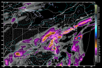
A pesky low pressure disturbance will slowly crawl up the east coast and contribute to a period of onshore flow this week. SNJ has the best chance to see any rainfall from the northern side of the system. I wouldn’t