

Hurricane Joaquin Update & Weekend Outlook
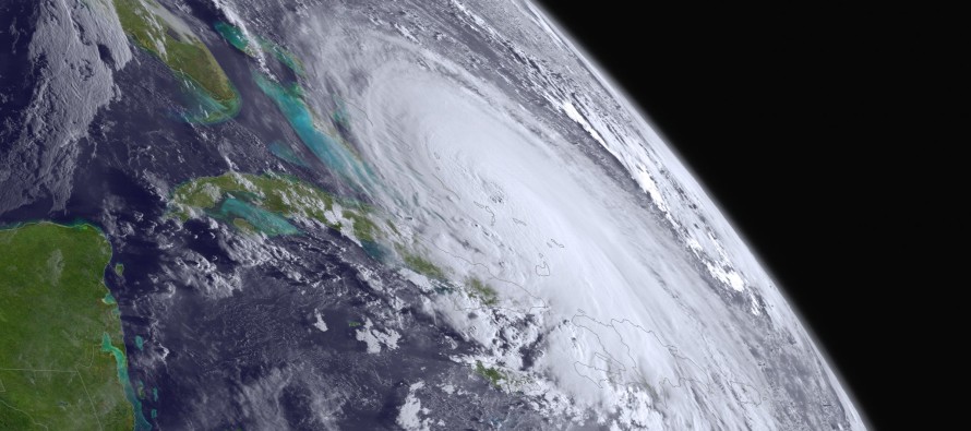
We have a lot to talk about. Joaquin is now a powerful category 4 hurricane in the Bahamas. You can monitor our Eye Wall for the latest current observations. The data is automatically updated as soon as the National Hurricane Center updates. Otherwise, here’s my latest track map for Hurricane Joaquin:
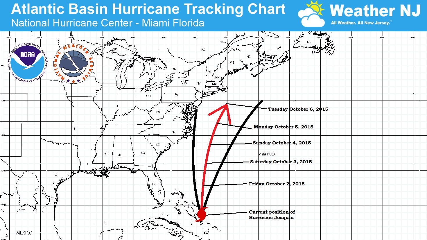
Joaquin Discussion: Most model guidance is now indicating a track out to sea. This is because they are not seeing a perfect capture like Sandy was. Instead, the upper level low/trough only interacts with Joaquin partially—allowing it to turn north but not a fish hook straight into New Jersey. With that said, I’m still leaning away from a Sandy replication. That, however, DOES NOT MEAN that you should let your guard down. There is still a chance that Joaquin could pass pretty close to New Jersey in the Monday-Tuesday window of time—close enough for heavy rain, high winds and multiple tidal cycles of above-normal ocean levels. A lot of you are already seeing water in the streets along barrier island/regions of the coast. From now until Tuesday, most of the east coast is subject to strong onshore flow (winds off the ocean). This, coupled with the rainfall we’ve had and will continue to have draining into creeks, streams and bays is adding up to the higher level tides you are seeing. Joaquin could be a category 1-2 hurricane as it passes New Jersey so this is far from written off completely!
With that said, my main concern is tidal flooding through Tuesday, especially during high tides. Also, I would expect surf conditions along the beach to be very hazardous for swimming, boating, etc. Therefore, even with a New Jersey landfall becoming less likely, I would still expect gusty winds (possibly damaging) along the shore and rainfall measured in inches. I’ll continue to monitor with morning and evening updates the way I’ve been doing. Again, I thank you for your patience and understanding so that I can give you the best quality information I can.
Weekend Outlook: The weekend looks very unsettled with onshore flow dominating the pattern. Let’s break each day down:
Friday high temperatures should reach the 50s (inland/elevations) and 60s (coastal regions). Skies should be mostly cloudy with rain possible. Winds should be stiff and gusty out of the NE (up to 25mph inland and possibly up to 50mph along the coast). Overnight lows should fall into the 40s (inland/elevations) and 50s (coastal regions).
Saturday high temperatures should reach the 50s (inland/elevations) and 60s (coastal regions). Skies should be mostly cloudy with rain possible. Winds should be stiff and gusty out of the NE (up to 25mph inland and possibly up to 50mph along the coast). Overnight lows should fall into the 40s (inland/elevations) and 50s (coastal regions).
Sunday high temperatures should reach the 60s statewide. Skies should be mostly cloudy with rain possible. Winds should be stiff and gusty out of the NE (up to 25mph inland and possibly up to 50mph along the coast). Overnight lows should fall into the 50s (inland/elevations) and lower-60s (coastal regions).
An early look at next week completely depends on what Joaquin does which I’ll be monitoring and covering very closely.
This weekend outlook is proudly sponsored by weathertrends360 (www.weathertrends360.com). Through 150 years of world wide weather data analysis, weathertrends360 has developed proprietary algorithms and methods that predict weather up to a year with 84% accuracy. They are second to none in the long range so check them out for business planning, travel planning, etc. Also check out their free txt and email alerts!
Be safe and have a great weekend! JC
Jonathan Carr (JC) is the founder and sole operator of Weather NJ, New Jersey’s largest independent weather reporting agency. Since 2010, Jonathan has provided weather safety discussion and forecasting services for New Jersey and surrounding areas through the web and social media. Originally branded as Severe NJ Weather (before 2014), Weather NJ is proud to bring you accurate and responsible forecast discussion ahead of high-stakes weather scenarios that impact this great garden state of ours. All Weather. All New Jersey.™ Be safe! JC


LOCAL FORECAST | INTERACTIVE RADAR | LATEST NJ WEATHER ALERTS | WEDDING FORECAST| PRIVACY POLICY
© Copyright 2026 Weather NJ LLC. All Rights Reserved.
Some information that can be found on our website is provided by a private weather station and is not an officially recognized station for weather reporting. Though we always strive to achieve accurate reporting for our own use, it is important that you do NOT depend on the data provided here for any purpose.
