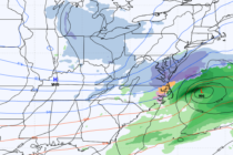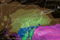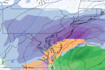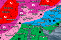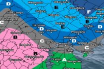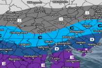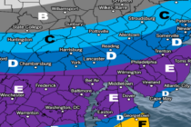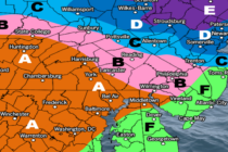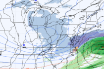
Snowstorm to Likely Graze SENJ
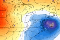
Discussion: This storm has certainly juked a lot of us forecasters around. In full and honest transparency, if I haven’t already made it clear, uncertainty is high with this. We’re dealing with specific phase timing required + a possible InVerted