Father’s Day Weekend Outlook (June 19-21)

Father’s Day Weekend Outlook (June 19-21)

🕔10:39, 19.Jun 2015

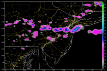
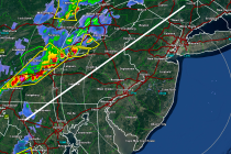
Remnants of Tropical Storm Bill will continue to approach our region from the west. In addition, high pressure will be moving across the Great Lakes and through New England over the weekend. This synoptic pattern should keep some of the

Read Full Article
Ring of Fire Week Expected (June 15-19)

Ring of Fire Week Expected (June 15-19)

🕔10:13, 15.Jun 2015

High pressure will setup in the SE US this week which will setup a classic “ring of fire” rainfall pattern. This will carry tropical disturbance remnant moisture from the W Gulf of Mexico over the central US and towards New

Read Full Article
Summery Weekend Expected (June 12-14)

Summery Weekend Expected (June 12-14)

🕔10:18, 12.Jun 2015

With haze, heat, humidity and isolated thunderstorms possible, this weekend looks pretty summery to me. We can thank the low pressure system moving through the Great Lakes assisted by high pressure in the Atlantic Ocean. Lets break it down: Friday

Read Full Article
June 11: Thunderstorms Expected!

June 11: Thunderstorms Expected!

🕔11:06, 11.Jun 2015

A frontal boundary will drape across extreme NNJ today. Everyone to the south of this boundary is subject to pop-up thunderstorms, especially during afternoon-early evening hours. Conditions in extreme NNJ (north of the boundary – ex: N. Sussex County) should remain mostly

Read Full Article
June 10: The Heat is On!

June 10: The Heat is On!

🕔19:26, 10.Jun 2015

Over the next few days we’ll be stuck in the warm sector of a low pressure disturbance passing through the Great Lakes. High pressure centered over Bermuda will spin humidity up its back (West) side which will assist in saturating

Read Full Article
June 8: Thunderstorms Approaching!

June 8: Thunderstorms Approaching!

🕔17:16, 8.Jun 2015

Rain and severe-warned thunderstorms are pushing through parts of Pennsylvania. Conditions are ripe for damaging winds and possibly tornadoes for areas well to the NW of I-95. The only part of New Jersey that could possibly be subject to such

Read Full Article
Week Begins Stormy. Ends Hot (June 8-12)

Week Begins Stormy. Ends Hot (June 8-12)

🕔19:36, 7.Jun 2015

Northerly low pressure will drag moisture through the region early this week. That should present the threat for rain and thunderstorms. Everything should improve by Wednesday morning as hot weather settles in to finish out the week. Let’s break it

Read Full Article
Mostly Nice Weekend Expected (June 5-7)

Mostly Nice Weekend Expected (June 5-7)

🕔19:15, 4.Jun 2015

This bizarre pattern that we’ve been in is about to improve. The weekend could start with lingering showers but high pressure will eventually invade from the N/NW and boot everything out of the region. Let’s break it down: Friday should top

Read Full Article
NJ Long Range Outlook – What to Expect through June!

NJ Long Range Outlook – What to Expect through June!

🕔12:16, 3.Jun 2015

It’s time to use the crystal ball and harness the WeatherTrends360 proprietary weather algorithms for a look at the rest of June 2015. But first lets break New Jersey into proper climatological regions. We have the upper elevations of NWNJ, the interior coastal

Read Full Article
Cooler Rainy Week Expected (June 1-5)

Cooler Rainy Week Expected (June 1-5)

🕔09:23, 1.Jun 2015

At least the first half of the week looks wet with much cooler temperatures than we’ve recently acclimated to. With a little luck we’ll be clear and sunny heading into the weekend depending on how much tropical moisture kicks up the

Read Full Article