Mixed Conditions Before the Cold Arrives
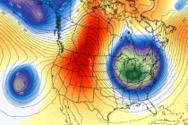
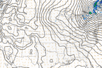
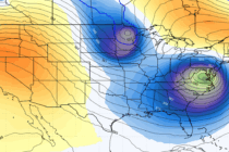
Discussion: 250mb analysis indicates zonal flow for this weekend before shaping into an aggressive trough by Monday with a raging PVA sector from coastal SE US through the 40N/70W benchmark. 500mb analysis jives with the 250mb look with a deep