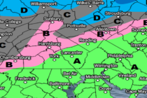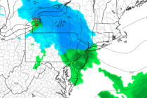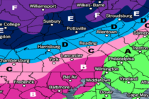
Another NNJ Snow Event Detected
Discussion: We’re now close enough to suggest a forecast for Thursday-Friday. We’ve watched this superblock linger near Greenland for a while now. This block will likely be located to the S of Greenland this Thursday-Friday. A primary surface low will