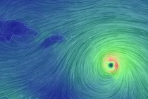
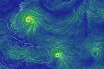
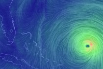
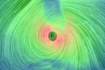
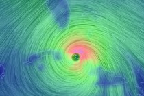
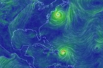
Back to homepage

Posts From Jonathan Carr

Cool Dry Weekend Expected (Mar 25-27)

Cool Dry Weekend Expected (Mar 25-27)

🕔12:52, 25.Mar 2016

Once the cold front pushes any remaining showers and/or weak thunderstorms out to sea, we’re looking at a dry and sunny weekend. Cooler though. Let’s break it down: Friday (Mar 25) high temperatures should reach well into the 60s for

Read Full Article
Mar 24: Possible Thunderstorms Detected

Mar 24: Possible Thunderstorms Detected

🕔10:07, 24.Mar 2016

We have an active weather pattern setting up over the next 24-36 hours. A cold front has backed into New Jersey from the NE, bringing a cold and cloudy Atlantic Ocean air mass to many locations. Our primary driver will be

Read Full Article
Mild Week Expected (Mar 21-25)

Mild Week Expected (Mar 21-25)

🕔12:39, 21.Mar 2016

The week might start chilly but were going to moderate towards mild temperatures by mid-week and likely stay that way into the weekend. Last night’s snow storm played out exactly as I expected. It was a ghost storm of mostly

Read Full Article
Mar 20: Updated Storm Impact Map

Mar 20: Updated Storm Impact Map

🕔10:45, 20.Mar 2016

Here is my latest and final storm impact map. This will be the last map I issue as we are now in live-casting mode: Dark blue area: This is my expected jackpot zone once rain changes over to snow. Roads

Read Full Article
Mar 19: Saturday Evening Observations

Mar 19: Saturday Evening Observations

🕔20:41, 19.Mar 2016

Overnight models took the storm east however today’s models have taken steps back west to how things sort of looked yesterday. Maybe a half step back. We’re getting to the point now where it’s time to live-cast. Precipitation has been training

Read Full Article
Mar 18: Weekend Outlook and Snow Map

Mar 18: Weekend Outlook and Snow Map

🕔20:41, 18.Mar 2016

Friday night (Mar 18) temperatures should drop into the 30s for most of the state. NNJ elevations could drop into the 20s. Winds should be light out of the N/NW. Saturday (Mar 19) high temperatures should reach the mid-40s statewide.

Read Full Article
Mar 17: Snow Storm Likely!

Mar 17: Snow Storm Likely!

🕔20:45, 17.Mar 2016

Model guidance continues to converge on a snow storm solution for the east coast this Sunday-Monday. Expected accumulation amounts are a little tricky to pin down at this exact moment but tomorrow evening I’ll have a very detailed storm impact

Read Full Article
Mar 15: Watching Sunday-Monday System

Mar 15: Watching Sunday-Monday System

🕔22:44, 15.Mar 2016

The most noticeable trend on today’s models was the eastward shift of the storm’s track. This is now being modeled as more of an offshore/coastal system rather than an inland runner/coastal hugger. That means that the low pressure system would

Read Full Article
Mar 14: Spring Storm Detected

Mar 14: Spring Storm Detected

🕔12:26, 14.Mar 2016

The first day of spring (this Sunday) could be a wet and windy day. Model guidance has been pretty persistent on a low pressure system tracking through the Mid-Atlantic US this Saturday-Sunday. This system should be all rain for most

Read Full Article
Unsettled Week Expected (Mar 14-18)

Unsettled Week Expected (Mar 14-18)

🕔20:33, 13.Mar 2016

This week looks unsettled. We should still squeeze in some sunshine however as mild temperatures continue. Let’s break it down. Monday (Mar 14) high temperatures should range from lower-40s for NNJ elevations to mid-50s for SNJ and the coast. Skies

Read Full Article