Mar 19: Saturday Evening Observations
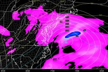
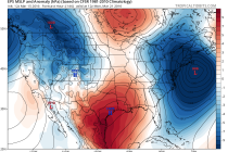
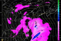
Overnight models took the storm east however today’s models have taken steps back west to how things sort of looked yesterday. Maybe a half step back. We’re getting to the point now where it’s time to live-cast. Precipitation has been training