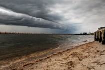
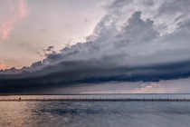
Back to homepage

Feature POST on Homepage

Feb 9: Tuesday Morning Observations

Feb 9: Tuesday Morning Observations

🕔08:39, 9.Feb 2016

Low pressure has jumped to the Mid-Atlantic coast and is moving out to sea. You can make out the cyclonic flow east of OBX on the Earth map image. Low pressure will also remain behind over the Great Lakes. The

Read Full Article
Feb 8: Monday Night Observations

Feb 8: Monday Night Observations

🕔22:06, 8.Feb 2016

The clipper has reached the end of its road near the Great Lakes. Over the next 6 hours, I expect it to transfer to the Mid-Atlantic coast as indicated below. It will then strengthen as it moves NE and help

Read Full Article
Feb 8: Snow Storm Approaching!

Feb 8: Snow Storm Approaching!

🕔17:56, 8.Feb 2016

Here’s are my thoughts heading into this redonkulously difficult forecast: Discussion: Low pressure is about to transfer from the Great Lakes to the Mid-Atlantic coast near the VA/NC border. It will then move NE into the Atlantic Ocean and bring upon

Read Full Article
Feb 8: Monday Morning Observations

Feb 8: Monday Morning Observations

🕔08:29, 8.Feb 2016

The coastal low has intensified below 980mb and continues to deepen. It’s located directly east of the Delmarva Peninsula but pretty far out to sea. It appears that the NW extent of its precipitation shield is just starting to impact

Read Full Article
Feb 7: Sunday Night Observations

Feb 7: Sunday Night Observations

🕔21:13, 7.Feb 2016

The coastal low has deepened down to about 986mb. Coastal New Jersey should already be feeling the NE winds associated with the cyclonic flow to the north of the low. This should begin elevating tides above normal. Once the winds eventually switch

Read Full Article
Feb 7: What to Expect Monday-Wednesday

Feb 7: What to Expect Monday-Wednesday

🕔13:42, 7.Feb 2016

As I sit here trying to make a final snow accumulations map, I’m realizing that there’s too much variance in what could possibly happen. Therefore, any snow map issued would have a tremendous likelihood of busting. I would rather be honest

Read Full Article
Feb 6: Winter Storm Discussion

Feb 6: Winter Storm Discussion

🕔09:54, 6.Feb 2016

The February 8-10 period has been of great interest to me for a while now. Not because of any particular surface solution modeled, but because of the consistency in the modeled upper-level pattern. If you’re looking for how much snow the

Read Full Article
Sunny Weekend Expected (Feb 5-7)

Sunny Weekend Expected (Feb 5-7)

🕔19:53, 5.Feb 2016

Today we saw lots of melting but tonight we’ll see lots of freezing. The weekend looks pretty good but next week is full of potential problems. Let’s break it down. Tonight’s temperatures should fall into the teens for NNJ elevations and 20s

Read Full Article
Long Range Outlook through February 2016

Long Range Outlook through February 2016

🕔10:37, 4.Feb 2016

It’s time to harness the WeatherTrends360 proprietary weather algorithms to see how the rest of February plays out. But first lets break New Jersey into proper climatological regions. We have the higher elevations of NNJ/NWNJ, the interior coastal plain (SWNJ through CNJ and into

Read Full Article
Feb 3: Coastal Snowfall Detected!

Feb 3: Coastal Snowfall Detected!

🕔20:02, 3.Feb 2016

  After the rain pushes through tonight, the cold front will stall just off our coast. A weak area of low pressure will then travel northward along the stationary front and throw in some moisture off the Atlantic Ocean into

Read Full Article