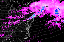
Back to homepage

Feature POST on Homepage

Cool and Unsettled Weekend Expected (Sept 11-13)

Cool and Unsettled Weekend Expected (Sept 11-13)

🕔09:35, 11.Sep 2015

Another low pressure disturbance will move through the region this weekend bringing cooler and unsettled conditions into at least part of Sunday. After that? High pressure domination with the biggest taste of fall yet! Let’s break it down. Friday high temperatures

Read Full Article
Sept 10: Rainfall Update

Sept 10: Rainfall Update

🕔11:19, 10.Sep 2015

“I don’t think the heavy stuff’s gonna come down for quite awhile.” – Carl Spackler, Caddyshack (1980) The current radar shows isolated-to-scattered showers and thunderstorms moving through our region. An area of heavy rainfall associated with a thunderstorm moved through

Read Full Article
Sept 9: Widespread Rainfall Detected!

Sept 9: Widespread Rainfall Detected!

🕔12:39, 9.Sep 2015

A series of low pressure disturbances will bring widespread rainfall to New Jersey starting later this evening/overnight and lasting through this weekend. Today is more of a hit-or-miss rainfall opportunity and mostly for NWNJ. Tomorrow, rainfall is expected throughout the entire

Read Full Article
Mixed Weather Expected (Sept 8-11)

Mixed Weather Expected (Sept 8-11)

🕔10:10, 8.Sep 2015

I hope everyone had a great Labor Day Weekend! The high pressure that brought us the stellar weather will now slide eastward into the Atlantic Ocean. A series of low pressure disturbances will ride a frontal boundary that should move through

Read Full Article
Labor Day Weekend Outlook (Sept 4-7)

Labor Day Weekend Outlook (Sept 4-7)

🕔09:25, 4.Sep 2015

The majority of the Labor Day Weekend looks pretty good with the caveat of onshore flow for highly populated coastal regions. Basically, the air will have the most amazing feel of the year so far but boating and beach conditions could be annoying. My

Read Full Article
Long Range Outlook: Closing Out Astronomical Summer

Long Range Outlook: Closing Out Astronomical Summer

🕔13:06, 2.Sep 2015

It’s time to harness the WeatherTrends360 proprietary weather algorithms for a look at the rest of astronomical summer (ends at 4:21AM on Wednesday AM, September 23). But first lets break New Jersey into proper climatological regions. We have the upper elevations of

Read Full Article
Warm and Humid Week Expected (Aug 31-Sept 4)

Warm and Humid Week Expected (Aug 31-Sept 4)

🕔10:59, 31.Aug 2015

High pressure will continue to dominate the region but temperatures and humidity should make it feel more like July than September. Let’s break each day down: Monday high temperatures should range from 85-90 with interior regions having the best chance

Read Full Article
Aug 29: Heat Wave Detected!

Aug 29: Heat Wave Detected!

🕔20:39, 29.Aug 2015

A strong ridge of re-enforced high pressure should continue building over the E. US. This will bring above-average temperatures to the entire mid-Atlantic region for the first third-to-half of September. I’ll be releasing the long-range September outlook (powered by WeatherTrends360)

Read Full Article
Aug 29: Tropics Update

Aug 29: Tropics Update

🕔09:42, 29.Aug 2015

Erika has remained extremely weak and has been downgraded to just a tropical depression. This is due to land interaction and the stronger shear environment of the northern Caribbean. Because of this, she has drifted westward considerably before making the

Read Full Article
Gorgeous Weekend Expected! (Aug 28-30)

Gorgeous Weekend Expected! (Aug 28-30)

🕔10:39, 28.Aug 2015

Total high pressure domination for a beautiful late-summer weekend. Let’s break it down… Friday high temperatures should reach the upper-70s and lower-80s statewide. Skies should be mostly sunny with a pleasant dry and crisp feel. Winds should be light out

Read Full Article