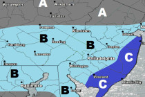
Jan 10: More Snow for the Weekend?
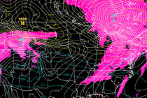
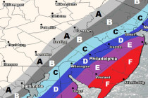
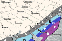
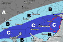
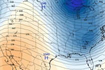
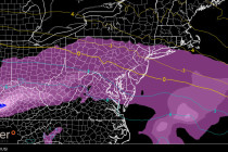
It’s a thread the needle situation but it just might time perfectly for some more snow this weekend. Let’s break it down… Disco: It has been well advertised on model guidance that the next few weeks of January will be on