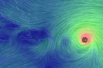
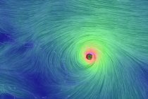
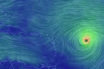
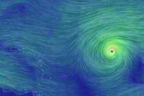
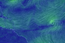
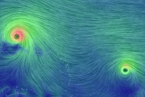
Mar 3: Friday Snow Map
Here is my wintry impact map heading into tonight: The light blue area should see snow showers with no mixing. A coating to an inch is possible. The darker blue area should see the most accumulations from this system. 1-2
A wintry event is likely late Thursday night into Friday. Model guidance has trended more aggressive with the intensity of the low as well as how far the precipitation shield extends northward. I’m fairly confident in at least light snow
It’s time to harness the WeatherTrends360 proprietary weather algorithms to see how March of 2016 should play out. But first lets break New Jersey into proper climatological regions. We have the higher elevations of NNJ/NWNJ, the interior coastal plain (SWNJ through CNJ and
The week should start with mild temperatures. A series of frontal passages should chill the region down by the weekend. Rain is possible along either front and the Friday-Saturday snow possibility depends on how much the polar vortex suppresses a low
Today we’ll be “getting there” but tomorrow will start a mild and sunny period through at least Tuesday. We’ll likely then see another interior low pressure system midweek bringing widespread rain to the region. The end of next week is
The volatile temperature pattern continues. Colder NW flow should dominate the first part of the weekend before warmer SW flow closes it out. Let’s break it down: Friday (Feb 26) high temperatures should range in the 30s statewide after a
My goal with this article is to educate you as I know the atmosphere, calm you a bit and help everyone be a little safer heading into tonight. Mesoscale severe wind events are incredibly difficult to forecast but that’s what
The system that brought snow, rain and wind to New Jersey today is on it’s way out to sea. The more powerful low will now track through the Ohio Valley, over the E Great Lakes and into Canada while rapidly
The first and weaker surface low is located just N of the Outer Banks in North Carolina. Precipitation has spread throughout the lower 2/3 of New Jersey and is slowly advancing northward. As far as the wintry precipitation profile goes, most
Most of the week looks unsettled with wintry precipitation possible tomorrow in NNJ and rainfall possible statewide through Thursday. We should then dry out for an okay weekend. Let’s break it down. Monday (Feb 22) high temperatures should reach the