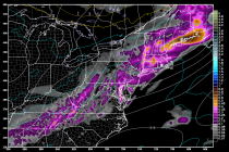
Weekend Looks Great after Wet Friday PM (Oct 9-11)
Once we get through today’s rain and possible embedded thunderstorms, the weekend looks great! High pressure will be moving in behind the cold front which will make for a cool, crisp, and dry (aside from AM dew) fall weekend. Let’s