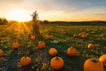
Fall Weather Holds Serve
Discussion: The upper-level pattern this week features a trough centered just to our E (ULL over Maine/SE Canada) and a steep ridge just to our W in NC US/SC Canada. This will keep the upper-level flow out of the NW


Discussion: The upper-level pattern this week features a trough centered just to our E (ULL over Maine/SE Canada) and a steep ridge just to our W in NC US/SC Canada. This will keep the upper-level flow out of the NW
Discussion: We have a few players shaping our conditions this week. At the upper-levels we have a ridge (still over E US) moving away to the E. This ridge should influence NJ with some warmer temps and humidity through about

Discussion: Invest 96L is currently sitting between the US and Bermuda at Georgia latitude. Whether or not it organizes into a named system is another story. But for today and tomorrow, it will impact the Jersey shore with higher surf

Discussion: A prolonged series of ridging should establish over the E US over the next 10 days or so. This will keep temps slightly warmer than average with above-average humidity. We should see several thunderstorms chances in this period. Not

Discussion: Despite what you might have read online, the rain and thunderstorms last night into today were associated with a typical slow moving cold front attached to a low tracking through Canada, and reinforced by weak low pressure sliding along

Discussion: Tuesday should be another great day like Monday. Wednesday we’ll see humidity build a little and then rain and thunderstorms likely Wednesday afternoon into early Thursday AM (slow moving cold front). This front could bring flash flooding rainfall and

Discussion: Last night was just crazy. It rained like the Book of Genesis in NNJ/CNJ and the scariest NJ tornado imagery I’ve seen yet came out of SWNJ/WCNJ. SENJ was very lucky to not experience the funky tropical cyclone remnant

LOCAL FORECAST | INTERACTIVE RADAR | LATEST NJ WEATHER ALERTS | WEDDING FORECAST| PRIVACY POLICY
© Copyright 2025 Weather NJ LLC. All Rights Reserved.
Some information that can be found on our website is provided by a private weather station and is not an officially recognized station for weather reporting. Though we always strive to achieve accurate reporting for our own use, it is important that you do NOT depend on the data provided here for any purpose.


