Another Winter Storm Possible

Another Winter Storm Possible

🕔15:26, 9.Feb 2022

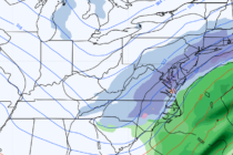
Discussion: Model data has been persistent on a ~Valentine’s Day winter storm signal since this past Saturday, Feb 5. The signal has ghosted in and out of day 5-9 long-range model guidance but here we are today 4 days out


Read Full Article▸
A Break from the Arctic

A Break from the Arctic

🕔15:01, 7.Feb 2022

Discussion: After the cold we’ve gotten used to over the 4-5 weeks, this week should feel like beach weather. Especially Friday-Saturday. We first have a weak coastal disturbance passing by today (Monday) through tomorrow (Tuesday). This should bring a cold

Read Full Article▸
Cold Dry Air Returns

Cold Dry Air Returns

🕔11:53, 4.Feb 2022

Discussion: A shallow trough will push all of today’s (Friday) rain-ending-wintry from NW to SE stuff out and set up a colder and much drier weekend. Mostly positive geopotential heights then move in for next week until the next likely

Read Full Article▸
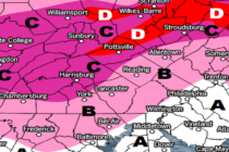
Ice Event Detected for Northern New Jersey

Ice Event Detected for Northern New Jersey Updated

🕔16:40, 2.Feb 2022

Discussion: High pressure is now off to our E/SE in the Atlantic Ocean providing warm and moist S/SW return flow for NJ. Many of you dealt with fog/freezing fog this morning since saturation occurred prior to surface temps warming above

Read Full Article▸
Icing Possible Friday

Icing Possible Friday

🕔15:58, 1.Feb 2022

Discussion: High pressure is currently offshore and will drop southward towards Bermuda by tomorrow (Wednesday) morning. This will set up a milder return flow from the Atlantic Ocean into the S and SW of NJ. This will be the mechanism

Read Full Article▸