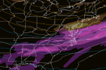
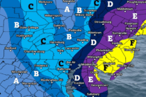
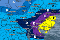
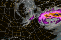
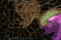
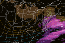
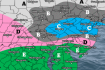
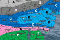
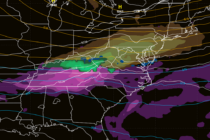
Back to homepage

Posts From Jonathan Carr

Tropical Feel

Tropical Feel

🕔17:56, 27.Jun 2025

Discussion: Hard to deduce much from 250/500mb levels. The jet will be a little N of NJ. Geopotential height anomalies are modeled only a little above average. But overall a near-zonal flow until a trough dips into the region Tuesday-Wednesday.

Read Full Article
Volatile Pattern Continues

Volatile Pattern Continues

🕔17:28, 26.Jun 2025

Discussion: Now that most of NJ is out of the oven (Mon-Wed heat) and resting (except for SWNJ and WCNJ – they are still cooking), I wanted to update for the coming weekend. Not quite yet the detailed weekend outlook

Read Full Article
The Heat is On

The Heat is On

🕔16:34, 23.Jun 2025

Discussion: In the words of the late Glenn Frey, “The Heat is On!” De na NA nana da NAna NAna! The upper jet, observed at 250mb, should stay well to the N of NJ this week. From 500mb analysis, a

Read Full Article
Strong Thunderstorms Possible

Strong Thunderstorms Possible

🕔16:10, 18.Jun 2025

Discussion: We’re now in a warm sector. The warm front is through and winds are changing to more of a SW direction with increasing temperatures and humidity. A round or two of showers and thunderstorms are possible today (Wednesday) and

Read Full Article
Summer Conditions Return

Summer Conditions Return

🕔16:25, 16.Jun 2025

Discussion: The upper-jet, observed at 250mb, should stay N of NJ for most of the foreseeable future outside of a small dip this Thursday-Friday. That jives with 500mb heights analysis of the bottom of an expected trough grazing through NJ

Read Full Article
Another Weekend with Rain

Another Weekend with Rain

🕔15:36, 13.Jun 2025

Discussion: The upper-jet, observed at 250mb, should stay to the N of NJ for the next week or so. This will keep NJ under slightly higher geopotential heights, observed at 500mb, for the same period—producing warmer conditions at the surface.

Read Full Article
Unsettled Conditions Continue

Unsettled Conditions Continue

🕔16:25, 9.Jun 2025

Discussion: The upper jet should be over of just N of NJ this week. That jives with the expected average profile of geopotential height anomalies of the near-zonal flow pattern. There will be an upper-low/trough lifting into SE Canada Tues-Wed

Read Full Article
Warm and Unsettled

Warm and Unsettled

🕔16:24, 5.Jun 2025

Discussion: Not too many changes in the evolution of this weekend’s forecast. We still have a slow-moving linear area of convergence that should push across NJ from NW to SE and meet up with a weak coastal disturbance. Not much

Read Full Article
Weekly Outlook – Summery Week. Rainy/Stormy End

Weekly Outlook – Summery Week. Rainy/Stormy End

🕔16:16, 2.Jun 2025

Discussion: The trough that dominated the weekend is moving out but the back-side of it is still around for today (Monday). 250mb wind and 500mb geopotential height analysis is concurrent in suggesting a ridge building behind the trough for much

Read Full Article
More Rain

More Rain

🕔14:05, 27.May 2025

Discussion: We’ve had a nice little break between the lower geopotential heights with current weak ridging. This allowed for an immaculate Saturday night through today (Tuesday). Another area of lower heights will start moving in late tonight. A few pieces

Read Full Article