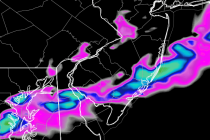
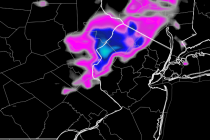
Back to homepage

Posts From Jonathan Carr

Bertha: Close But No Cigar

Bertha: Close But No Cigar

🕔09:18, 5.Aug 2014

Yesterday, Bertha was upgraded to a category 1 hurricane but has since been downgraded back to a tropical storm. Today she will parallel coastal Jersey about 300 miles offshore before turning to the northeast and moving out for good. Here’s

Read Full Article
Bertha to impact Jersey Shore (Aug 5-6)

Bertha to impact Jersey Shore (Aug 5-6)

🕔10:39, 4.Aug 2014

It’s peak season at the Jersey Shore. Hundreds of thousands of people are populating the barrier islands as soon-to-be Hurricane Bertha is taking shape. Expected coastal impacts are the most we will see from Bertha. This includes above-average wave heights,

Read Full Article
Your Weekly Forecast – Mixed & Sunny! (Aug 4-8)

Your Weekly Forecast – Mixed & Sunny! (Aug 4-8)

🕔19:26, 3.Aug 2014

New Jersey weather will be very unsettled for the first half of this week. It might be Thursday before that changes back to drier cooler weather. Tropical impacts from Bertha should be confined to just coastal surf. It’s peak season

Read Full Article
NOAA: Bertha has Formed!

NOAA: Bertha has Formed!

🕔09:42, 1.Aug 2014

Tropical Storm Bertha has formed in the Atlantic Ocean and is heading towards the Leeward Island portion of the Lesser Antilles. The latest computer model guidance suggests that Bertha will then turn towards the Bermuda region after possibly passing near/over

Read Full Article
Weekend Washout Expected (Aug 1-3)

Weekend Washout Expected (Aug 1-3)

🕔10:34, 31.Jul 2014

I’ve been analyzing multiple weather models (US and foreign) and weather trends for a few days now. Most guidance suggests periods of soaking rain throughout the weekend. As far as exact timing goes, Saturday morning through early afternoon should feature

Read Full Article
Rainy Weekend Possible (Aug 2-3)

Rainy Weekend Possible (Aug 2-3)

🕔10:39, 30.Jul 2014

Just one more cooler day to get through. Winds should shift to a southwesterly flow today which will bring warmth and humidity northward into our region tomorrow. As we head into the weekend, I’m currently watching a low pressure disturbance 

Read Full Article
July 28: Watching the Tropics

July 28: Watching the Tropics

🕔21:39, 28.Jul 2014

A tropical wave in the Atlantic Ocean will become a tropical depression in the next few days and ultimately Bertha. Despite being surrounded by dry air, this wave is indeed showing signs of strengthening. Current projected track is extremely uncertain this

Read Full Article
Cooler Summer Continues (July 28-Aug 1)

Cooler Summer Continues (July 28-Aug 1)

🕔10:40, 28.Jul 2014

Another cool air mass is moving into the region from the northwest. The low pressure disturbance that brought last night’s storms is moving out while high pressure moves in behind a cold front. This should keep most of the week

Read Full Article
July 27: It’s Show Time

July 27: It’s Show Time

🕔21:33, 27.Jul 2014

Thunderstorms are moving into western New Jersey (Philly-northward). They will continue to push ENE until they clear out to sea. These storms should continue to push towards the NYC Metro area overnight. Due to cooler air aloft, there are many

Read Full Article
July 27: Evening Storms Approaching!

July 27: Evening Storms Approaching!

🕔18:34, 27.Jul 2014

Thunderstorms continue to push ENE across Pennsylvania towards New Jersey. They’re not moving very fast so estimated impact is still at least a few hours away. Given the current setup and radar observations, it appears that NNJ has a better

Read Full Article